ID 819744
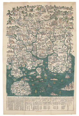
Los 52 | Map of Guangdong Province
Schätzwert
$ 100 000 – 150 000
China: c.1739
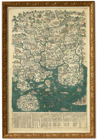
Xylographic map of Guangdong, ink and colors on paper, approximately 1635 x 1030mm (64 x 40 1/2 inches). Among the four orientations noted in the margins, Guangzhou is situated prominently as the largest city near-center of the map. Rivers and ocean colored in blue-green, cities with toponyms surrounded by city walls and these too surrounded by explanatory text in square or rectangular notation. Mountains rendered as quasi-realistic rock formations in blue and pink, with surrounding vegetation in green. Explanatory text is located in the lower margin. A few manuscript captions in a neat 18th century or early 19th century English hand, titling the map in lower margin, labeling the "City of Canton" and six other place names. Very good condition with vivid colors (previously folded with 4 tiny holes at fold intersections, approx. 6" tear in the upper left neatly repaired, some ink burn at manuscript captions, including one with slight loss). Framed.
Provenance
Jesuit College of Louis le Grand 1764.
Gerard Meerman (1722-1771).
Jean Meerman.
Sir Thomas Phillips (purchased in 1821).
Lionel and Philip Robinson (purchased in 1946).
The Library of Philip Robinson Part II: The Chinese Collection, Sotheby's, 22 November 1988, lot 95.
Third Session: China Trade Paintings, Sotheby's Hong Kong, 31 October 1991, lot 600.
Acquired by Ann and Gordon Getty from the above.
Literature
L. Bagrow. ‘The cartography of Asian peoples’ in History of cartography, revised and enlarged by R.A. Skelton, London: C.A. Watts & Co., 1964, pp. 197-211
[Y. Jones, H. Nelson & H. Wallis.] Chinese & Japanese Maps. [Exhibition catalogue.] Entry C21. London: British Museum, 1974.
H. Nelson. ‘Chinese maps: an exhibition at the British Library’ in The China Quarterly. London: April-May 1974, pp. 357-362.
L. Hostetler. Mapping territory; Qing colonial enterprise ethnography and cartography in early modern China, Chicago: The University of Chicago Press, 2001, pp. 51-80
R.J. Smith. Chinese maps; images of ‘All Under Heaven’. Hong Kong: Oxford University Press, 1996.
R.J. Smith. Mapping China and managing the World; Culture, Cartography and Cosmology in late Imperial times. London: Routledge, 2013.
L. Xiaocong. A Descriptive catalogue of pre-1900 Chinese maps seen in Europe, Beijing: Guoji wenhua, 1996. pp. 162-163.
C.D.K. Yee. ‘Traditional Chinese cartography and the myth of Westernization’ in Cartography in the Traditional East and Southeast Asian Societies. Vol. 2.2 of The History of Cartography, eds. J. B. Harley and David Woodward, 170-202. Chicago: University of Chicago Press, 1994.
Exhibited
[Y. Jones, H. Nelson & H. Wallis.] Chinese & Japanese Maps.[Exhibition catalogue.] Entry C21. London: British Museum, 1974.
| Herkunftsort: | China, Ostasien, Asien |
|---|---|
| Kategorie des Auktionshauses: | Karten und Atlanten |
| Herkunftsort: | China, Ostasien, Asien |
|---|---|
| Kategorie des Auktionshauses: | Karten und Atlanten |
| Adresse der Versteigerung |
CHRISTIE'S 20 Rockefeller Plaza 10020 New York Vereinigten Staaten | ||||||||||||||
|---|---|---|---|---|---|---|---|---|---|---|---|---|---|---|---|
| Vorschau |
| ||||||||||||||
| Telefon | +1 212 636 2000 | ||||||||||||||
| Fax | +1 212 636 4930 | ||||||||||||||
| Nutzungsbedingungen | Nutzungsbedingungen | ||||||||||||||
| Versand |
Postdienst Kurierdienst Selbstabholung | ||||||||||||||
| Zahlungsarten |
Banküberweisung | ||||||||||||||
| Geschäftszeiten | Geschäftszeiten
|


