ID 519405
Lot 114 | United States Geological Survey and The Arabian American oil Company
Estimate value
£ 4 000 – 6 000
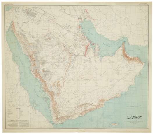
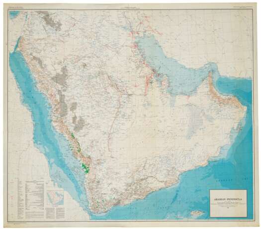
Arabian Peninsula. Washington DC: Department of the Interior, United States Geological Survey and the Kingdom of Saudi Arabia Ministry of Finance, 1958 and 1963.
First and second editions of the base map used in all future geological maps of the Arabian peninsula. Under the leadership of King Abdulaziz Ibn Saud (1875-1953), the majority of the Arabian peninsula was unified and the Kingdom of Saudi Arabia established in 1932. One of his most pressing concerns was to ascertain what the country's natural resources were in general, and more specifically, its groundwater reserves. Consequently a partnership between the Kingdom and the United States Geological Survey was established. In 1945, the USGS together with Aramco surveyed much of western and central Arabia. Impressed, the Saudis expanded the survey and its objectives to include natural resources such as oil and gas, and added the innovative use of aerial photography and reconnaissance to speed up the process dramatically.
By 1953, the USGS, in conjunction with Aramco, the U.S. Ambassador to Saudi Arabia, and Sheikh Abdullah Sulaiman, then Minister of Finance of the Government of Saudi Arabia, formalised their commitment to a co-operative venture to geologically map the entirety of the Arabian peninsula. From the outset it was envisaged to create both Arabic and English versions of the cartography. The information they obtained formed the basis of all subsequent Saudi national development plans. This lot contains the 1958 first edition of the topographic base map (I-270 B-1), and the second edition (I-270 B-2) with its greater topographic detail, including areas under cultivation, and depiction of infrastructure such as roads and pipelines. The increased geographical areas marked as oil fields stand in stark contrast to its earlier edition, and are testament to the speed of growth and development of the Kingdom of Saudi Arabia in only 5 short years.
2 large folding chromolithographic wall maps, the Arabian peninsula shown with topographic relief, and with water pipelines, oases, oil fields, oil pipelines, ports and harbours, oil wells, natural gas fields, quarries and mines, key to lower left, Saudi Arabia’s northern borders delineated, title to lower-right in Arabian Sea with scale 1:2,000,000, first edition in Arabic, second edition in English (both maps 1220 x 1395mm).
| Place of origin: | Saudi Arabia |
|---|
| Place of origin: | Saudi Arabia |
|---|
| Address of auction |
CHRISTIE'S 8 King Street, St. James's SW1Y 6QT London United Kingdom | |
|---|---|---|
| Preview |
| |
| Phone | +44 (0)20 7839 9060 | |
| Buyer Premium | see on Website | |
| Conditions of purchase | Conditions of purchase |


