ID 1105592
Los 97 | MOLL, Herman (c.1654-1732)
Schätzwert
£ 4 000 – 6 000
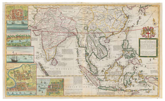
A Map of the East-Indies. [London:] Herman Moll, [c.1720].
Fine large and highly decorative map of the East Indies, one of the first English two-sheet maps of the area. The map stretches from India to Papua New Guinea, and bears several large insets of the area’s most important trading posts. The map is dedicated to the Directors of the East India Company, whose coat-of-arms can be seen above the title.
Hand-coloured engraved map of south-east Asia including China, Taiwan and part of Japan on 2 sheets, joined, title panel surmounted by the coat-of-arms of the East India Company, inset views of Goa and Surat, inset plans of Bantam, Fort St. George and Madras, and Batavia, 616 x 1,010mm (plate mark), 628 x 1043mm (sheet).
| Adresse der Versteigerung |
CHRISTIE'S 8 King Street, St. James's SW1Y 6QT London Vereinigtes Königreich | ||||
|---|---|---|---|---|---|
| Vorschau |
| ||||
| Telefon | +44 (0)20 7839 9060 | ||||
| Aufgeld | see on Website | ||||
| Nutzungsbedingungen | Nutzungsbedingungen |


