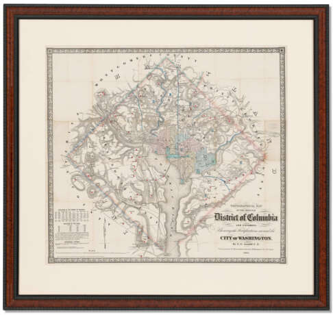
Topographical Map of the District of Columbia and Environs: Showing the Fortifications

Lot 158
25.04.2022 10:00UTC -05:00
Classic
Sold
$ 8 190
AuctioneerCHRISTIE'S
Event locationUSA, New York
Archive
The auction is completed. No bids can be placed anymore.
Archive
ID 743818
Lot 158 | Topographical Map of the District of Columbia and Environs: Showing the Fortifications
Estimate value
$ 7 000 – 10 000
WASHINGTON, D.C. – ARNOLD, E.G. Topographical Map of the Original District of Columbia and Environs: Showing the Fortifications Around the City of Washington. New York: G. Woolworth Colton, 1862.Extremely rare and large map of Washington, D.C., confiscated within days of publication by the U.S. War Department. This highly detailed map was produced by G.E. Arnold, a civil engineer, in New York. He depicts the original 10-mile square of D.C. as laid out by Peter L’Enfant and surveyed by Andrew Ellicott, and also includes the city of Alexandria. “The seven wards within D.C. are color coded, and [Arnold] showed all railroad lines and regional roads entering the city. In a chart at the lower left, Arnold lists the populations of Washington, Georgetown, and Alexandria by decade from 1800-1860. He also broke down the population into ‘white,’ ‘free colored,’ and ‘slave.’To Union Military authorities, the Arnold map was important for three reasons: it showed the topography of the area, all the roads leading into the city, and the location of the then 51 forts protecting the city. Arnold published this three-foot-square folding map without the knowledge or consent of the government. Two days after Arnold placed copies of his map in Washington bookstores and retail shops, the War Department seized most copies in stock to prevent the vital military intelligence from reaching Confederate forces. The War Department obtained the names of many purchasers of the map and seized their copies from their homes. The War Department also confiscated the copper plate in New York from which the map was printed” (Goode). James Goode, “Civil War Washington." In: Washington History, Vol 15:1 (2003), p. 77; Phillips 1023. Hand-colored engraved map, 790 x 865mm sight size (mild toning at previous folds). Archivally matted, framed and glazed to 44 x 48 inches. Provenance: C.F. Schwab (period inkstamp on verso is visible on recto).
Address of auction CHRISTIE'S
20 Rockefeller Plaza
10020 New York
USA
Preview
11.04.2022 – 25.04.2022
Phone +1 212 636 2000
Fax +1 212 636 4930
Email
Conditions of purchaseConditions of purchase
Shipping Postal service
Courier service
pickup by yourself
Payment methods Wire Transfer
Business hoursBusiness hours
Mo 09:30 – 17:00   
Tu 09:30 – 17:00   
We 09:30 – 17:00   
Th 09:30 – 17:00   
Fr 09:30 – 17:00   
Sa closed
Su closed

Related terms