Cartographers 16th century
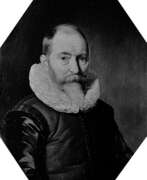

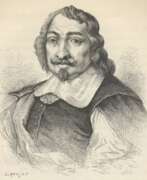
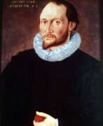
Willem Janszoon Blaeu was a Dutch cartographer and map publisher.
Willem studied astronomy and cartography under the Danish astronomer Tycho Brahe and even discovered the variable star P Swan in 1600. A little later Blaeu settled in Amsterdam, where he began making globes and also began producing land and sea maps, including a 1605 world map. In 1629 he managed to acquire the printing plates of the cartographer Jodok Hondius, with which he published his own atlas.
In 1633, Willem Blaeu was appointed cartographer of the Dutch Republic, as well as the official cartographer of the Dutch East India Company. Blau built up a large collection of maps and conducted an extensive publishing business. After Willem's death, his sons Jan Blaeu (1596-1673) and Cornelius Blaeu successfully continued his work. But in 1672, during a fire in Amsterdam, Blaeu's workshop was destroyed, and the company founded by Willem Blaeu ceased to exist in 1698.
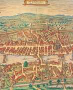

Georg Braun was a German topographical geographer, cartographer and publisher.
Braun was the editor-in-chief of the Civitates orbis terrarum, a groundbreaking atlas of cities, one of the major cartographic achievements of the 16th century. It was the first comprehensive and detailed atlas, with plans of the world's famous cities and bird's-eye views, and became one of the best-selling works of the time.
The book was prepared by Georg Braun in collaboration with the Flemish engraver and cartographer Frans Hoogenberg. Braun, as editor-in-chief, acquired tables, hired artists, and wrote the texts. They drew on existing maps as well as maps based on drawings by the Antwerp artist Joris Hofnagel and his son Jacob. Other authors include Pieter Bruegel the Elder (c. 1525-1569), Jacob van Deventer (c. 1505-1575), and more than a hundred other artists and engravers.
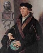

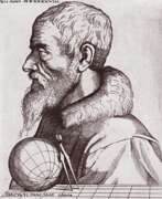
Gemma Frisius, born Jemme Reinerszoon Frisius, was a Dutch mathematician, physician, cartographer, philosopher, engraver, and master of astronomical instruments.
He taught mathematics and medicine at the University of Leuven and applied his mathematical knowledge to astronomy, geography, and map-making. Frisius participated in the creation of the latest globes and used mathematics in geodesy and navigation in new ways and invented or improved many instruments, including the cross staff, the astrolabe, and the astronomical rings (also known as "Gemma rings"). He ran a workshop for making such instruments.
Frisius is credited with being one of the founders of the Dutch school of cartography.
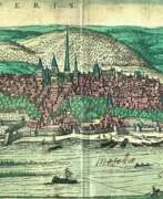

Frans Hogenberg was a Flemish and German painter, engraver, and mapmaker. He is known for portraits and topographical views as well as historical allegories. He also produced scenes of contemporary historical events. Hogenberg was the author of graphic works, engravings of city views and maps of the first four volumes of the six-volume atlas Theatrum Orbis Terrarum (Description and drawings of the most famous cities in the world), published in 1570 by the Flemish geographer Abraham Ortelius. Hogenberg's engravings are an invaluable source of information about urban development in medieval Europe.
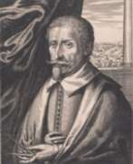

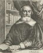
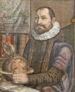
Hendrik Hondius I was a Flemish-born and trained engraver, cartographer, and publisher who settled in the Dutch Republic in 1597. Hondius was apprenticed in Brussels to Godfried van Ghelder, goldsmith to Alexander Farnese, Duke of Parma. He also studied drawing with the engraver Jan Wierix of Antwerp. At this time he started to study engraving. He applied himself to mathematics and studied perspective, architecture and the construction of fortifications. He moved to The Hague by 1597. He obtained his first print privilege for a portrait of Prince Maurits. He dedicated himself to his engraving practice. His work was very well received and he got commissions from many eminent personalities for engravings or drawings. He turned more to publishing rather than engraving and printing in the 1630s. His publications were mainly maps, books about fortifications and official portraits.[5] He also reused original plates and blocks by earlier artists for reprinting and such reprints represented almost a third of his publishing output. In the 1640s he returned to printing concentrating exclusively on etching. One of the most important publications of Hondius was the work Pictorum aliquot celebrium praecipue Germaniae inferioris Effigies (Effigies of some celebrated painters, chiefly of Lower Germany) of 1610, which was a collection of 69 portraits of mainly Netherlandish artists.
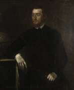

Gerardus Mercator, birth name Gheert Cremer was a Flemish geographer and cartographer, best known for the map projection that bears his name.
Gerardus Mercator was the first to use this equiangular cylindrical projection for drawing a navigational chart of the world on 18 sheets (1569). The Mercator projection is remarkable in that it does not distort angles and shapes and only keeps distances at the equator. It is currently used for nautical navigational and aeronautical charts. Although modern historical cartographic research has established that this projection was used as early as 1511, it is only by Mercator that it has become widely used.
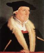

Sebastian Münster was a German Renaissance scholar, cartographer and cosmographer, historian and linguist-translator.
Münster studied at the University of Tübingen and later taught at the Universities of Basel and Heidelberg. He published several editions of Hebrew grammars and translations from that language, and was the first German to produce an edition of the Hebrew Bible.
In 1544 Münster published his Cosmographia, which was the earliest description of the history, geography, and organization of the world in German. This book was a great success, translated into many European languages and reprinted more than twenty times. "Cosmographia" contained many illustrations and geographical maps of the continents of the world, created by the best engravers of the time.
Among his other works were the "Trilingual Dictionary" (1530) in Latin, Greek, and Hebrew and the "Map of Europe" (1536).
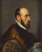

Abraham Ortelius (Ortels) was a Brabantian cartographer, geographer, and cosmographer. He is recognized as the creator of the first modern atlas, the Theatrum Orbis Terrarum (Theatre of the World). Along with Gemma Frisius and Gerardus Mercator, Ortelius is generally considered one of the founders of the Netherlandish school of cartography and geography. He was a notable figure of this school in its golden age (approximately 1570s–1670s) and an important geographer of Spain during the age of discovery. The publication of his atlas in 1570 is often considered as the official beginning of the Golden Age of Netherlandish cartography. He was the first person proposing that the continents were joined before drifting to their present positions. Beginning as a map-engraver, in 1547 he entered the Antwerp Guild of Saint Luke as an illuminator of maps. In 1560 when travelling with Mercator to Trier, Lorraine, and Poitiers, he seems to have been attracted, largely by Mercator's influence, towards the career of a scientific geographer. In 1564 he published his first map, Typus Orbis Terrarum, an eight-leaved wall map of the world. On 20 May 1570, Gilles Coppens de Diest at Antwerp issued Ortelius's Theatrum Orbis Terrarum, the "first modern atlas" (of 53 maps).
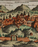

Giuseppe Rosaccio was an Italian physician, astronomer, cosmographer and cartographer.
Rosaccio graduated from the University of Padua, studied philosophy, medicine and law, and worked as a physician and judge. He became famous for a series of works that popularized a number of scientific disciplines. Some of his books deal with astrological medicine, specific diseases and their remedies, and the distillation of medicines from plants.
Giuseppe Rosaccio wrote about forty works on various topics of interest to him, but the main one was geography. He wrote an essay on the Muslim religion and treatises on geography, cosmography, astronomy, and astrology, which became very popular and were repeatedly reprinted.
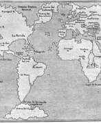
Rosaccio created many atlases and small-format geographical works. Among his works is Ptolemy's Geography, which contains many indexes and is written in Italian (1599). He also authored a large map of the world (1597), and a large map of Italy and Tuscany (1609). His book Journey from Venice to Constantinople includes maps of the route with brief texts, that is, it is essentially an illustrated version of a pilgrimage to the Holy Land.
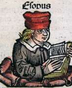

Hartmann Schedel was a German humanist, medical scientist, historian and chronicler.
Schedel was the first to compile a world chronicle, the so-called Visual History of the Earth from the Creation of the World to the 1490s, known as Schedelsche Weltchronik (Schedel's World Chronicle). It was published in 1493 in Nuremberg. About 600 woodcuts for this book were created by the artists and engravers Michael Wolgemuth (1434-1519) and Albrecht Dürer (1471-1528). The illustrations depict biblical scenes, family trees, portraits of famous personalities, and fairy tale or legendary creatures. However, the main ones here were maps of the world, Germany and Central Europe.
Hartmann Schedel was one of the first cartographers to use machine printing. He was also a renowned collector of books, artworks and engravings by old masters.
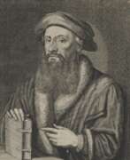

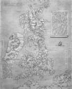
Johannes Stumpf was an early writer on the history and topography of Switzerland as well as a theologian and cartographer.
When he converted to Protestantism, Stumpf had carried over with him most of his parishioners, whom he continued to care for, as the Protestant pastor at Bubikon, till 1543.
Stumpf also published a monograph (very remarkable for the date) about Henry III, Holy Roman Emperor (1556) and a set of laudatory verses about each of the thirteen Swiss cantons.
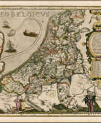

Pieter van der Keere (Latin: Petrus Kaerius) was a Flemish engraver, publisher, cartographer and globe maker.
His father was the master of typefaces Hendrik van der Keere (c. 1540-1580); in 1584 he fled from the Netherlands to London, where he lived most of his life. Pieter van der Keere produced engravings and atlases. From 1603, Kere began to produce large city panoramas, including Utrecht, Cologne, Amsterdam and Paris.
An atlas of the Netherlands was published in 1617, with der Keere's name as publisher and his full signature on several maps. He also produced topographical maps of Amsterdam and Nuremberg, as well as a world map ("Nova totius terrarum orbis..."), which was printed by Jan Janszoon in Amsterdam.
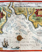

Lucas Waghenaer, full name Lucas Janszoon Waghenaer, was a famous Dutch cartographer, navigator, navigator and writer of the Golden Age.
Between 1550 and 1579, Waghenaer sailed the seas as a senior assistant captain and probably socialized with Portuguese, Spanish, and Italian navigators. The knowledge of nautical charts and the instructions Waghenaer received as a result of these contacts had a great influence on his later work as a cartographer. It is evident that the charts he made had to be based on his observations, and in all his work he had to draw on his own extensive experience of practical navigation. His book Spieghel der Zeevaerdt ("The Navigator's Mirror") or Speculum nauticum super navigatione, first published in 1584, occupies a unique place among the nautical printed works of the sixteenth century, for it is the first printed work with maps.
Moreover, in terms of the magnificent design of the maps and text, it surpasses all other editions of this period and served as a model for pilotage guides and folios with maps even a century later. It is an atlas of nautical charts with instructions for navigation in the western and northwestern coastal waters of Europe. Thanks to the unrivaled skill of engravers Baptiste and Johannes van Deitekom, Waghenaer's original maps were transformed into the most beautiful maps of the time. This book was a huge success, reprinted several times and translated into English, German, Latin and French.
In 1592, Waghenaer's second pilot book Thresoor der zeevaert ("Treasure of Navigation") was published, and in 1598, the third and last publication Enchuyser zeecaertboeck ("Enkhuizen Book of Nautical Charts").


