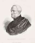
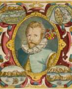
Geographers 16th century
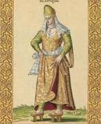

Nicolas de Nicolay, Sieur d'Arfeville & de Belair was a French geographer and artist.
He traveled in Germany, Denmark, England, Sweden, Italy, Spain, Greece and Turkey and served in the armies of most of these countries. Nicholas was the king's geographer, and in 1551 Henry II sent him to Constantinople to work on the d'Aramont embassy. This enabled Nicolas to see a world hitherto virtually unknown in the West. As a result of his work, Nicolas published Travels in Turkey (1567), which depicts the costumes of the peoples of the Middle East, representatives of various nationalities and ethnicities, including Turks, Greeks, Armenians, Jews, and pilgrims to Mecca.
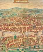

Georg Braun was a German topographical geographer, cartographer and publisher.
Braun was the editor-in-chief of the Civitates orbis terrarum, a groundbreaking atlas of cities, one of the major cartographic achievements of the 16th century. It was the first comprehensive and detailed atlas, with plans of the world's famous cities and bird's-eye views, and became one of the best-selling works of the time.
The book was prepared by Georg Braun in collaboration with the Flemish engraver and cartographer Frans Hoogenberg. Braun, as editor-in-chief, acquired tables, hired artists, and wrote the texts. They drew on existing maps as well as maps based on drawings by the Antwerp artist Joris Hofnagel and his son Jacob. Other authors include Pieter Bruegel the Elder (c. 1525-1569), Jacob van Deventer (c. 1505-1575), and more than a hundred other artists and engravers.
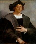

Christopher Columbus (Spanish: Cristóbal Colón, Latin: Christophorus Columbus, Italian: Cristoforo Colombo) was a medieval Spanish navigator of Italian origin who discovered the New World in 1492.
About the exact origin of Columbus scientists argue to this day. He already from his youth had a brilliant knowledge of mathematics, knew several languages, including Latin. Columbus was familiar with the teachings of ancient Greek philosophers and thinkers who depicted the Earth as a sphere, not flat, as was believed in the Middle Ages. Christopher was also trained in the art of navigation and made his first voyages as a young man in the Mediterranean Sea, later sailing to Africa and participating in a northern expedition through the British Isles and Iceland.
Gaining experience, studying geography and maps, Columbus assumed that it was possible to reach India by the western route. He sought financial support from European monarchs, but only the Spanish monarch was interested in the prospects. He agreed and borrowed money to outfit a squadron of ships to find a western route to India.
Christopher Columbus made four historic voyages to the shores of America: August 3, 1492 - March 15, 1493; September 25, 1493 - June 11, 1496; May 30, 1498 - November 25, 1500 and May 9, 1502 - November 7, 1504. Expeditions of Columbus for the first time made information about the lands in the west common knowledge and began the colonization of America by Europeans. But the discoverer of new lands to the end of his life was convinced that he had discovered the richest Western India.
From the last expedition Columbus returned to Spain terminally ill, his last money he spent to pay debts to its participants. Two years later, the discoverer of the New World died in poverty in a small house. Columbus's discoveries, accompanied by the colonization of land, the establishment of Spanish settlements, enslavement and mass extermination of the indigenous population, which he called Indians, were of world significance.
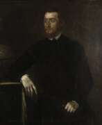

Gerardus Mercator, birth name Gheert Cremer was a Flemish geographer and cartographer, best known for the map projection that bears his name.
Gerardus Mercator was the first to use this equiangular cylindrical projection for drawing a navigational chart of the world on 18 sheets (1569). The Mercator projection is remarkable in that it does not distort angles and shapes and only keeps distances at the equator. It is currently used for nautical navigational and aeronautical charts. Although modern historical cartographic research has established that this projection was used as early as 1511, it is only by Mercator that it has become widely used.
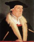

Sebastian Münster was a German Renaissance scholar, cartographer and cosmographer, historian and linguist-translator.
Münster studied at the University of Tübingen and later taught at the Universities of Basel and Heidelberg. He published several editions of Hebrew grammars and translations from that language, and was the first German to produce an edition of the Hebrew Bible.
In 1544 Münster published his Cosmographia, which was the earliest description of the history, geography, and organization of the world in German. This book was a great success, translated into many European languages and reprinted more than twenty times. "Cosmographia" contained many illustrations and geographical maps of the continents of the world, created by the best engravers of the time.
Among his other works were the "Trilingual Dictionary" (1530) in Latin, Greek, and Hebrew and the "Map of Europe" (1536).
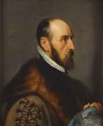

Abraham Ortelius (Ortels) was a Brabantian cartographer, geographer, and cosmographer. He is recognized as the creator of the first modern atlas, the Theatrum Orbis Terrarum (Theatre of the World). Along with Gemma Frisius and Gerardus Mercator, Ortelius is generally considered one of the founders of the Netherlandish school of cartography and geography. He was a notable figure of this school in its golden age (approximately 1570s–1670s) and an important geographer of Spain during the age of discovery. The publication of his atlas in 1570 is often considered as the official beginning of the Golden Age of Netherlandish cartography. He was the first person proposing that the continents were joined before drifting to their present positions. Beginning as a map-engraver, in 1547 he entered the Antwerp Guild of Saint Luke as an illuminator of maps. In 1560 when travelling with Mercator to Trier, Lorraine, and Poitiers, he seems to have been attracted, largely by Mercator's influence, towards the career of a scientific geographer. In 1564 he published his first map, Typus Orbis Terrarum, an eight-leaved wall map of the world. On 20 May 1570, Gilles Coppens de Diest at Antwerp issued Ortelius's Theatrum Orbis Terrarum, the "first modern atlas" (of 53 maps).
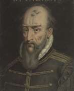

Bernard Palissy was a French natural scientist, painter, ceramicist and sculptor, geologist and writer of the French Renaissance.
Born into a family of artisans, Palissy apprenticed with his father as a glass artist and traveled throughout southwestern France comprehending pottery and studying geology. Today he is best known for his amazing lead-glazed pottery with images of various animals and people. After seeing a white glazed cup, probably of Chinese porcelain, in the 1540s, he set out to learn the secrets of its manufacture. His early research is described in De l'art de la terre. Although Palissy never succeeded in reproducing what he saw, his experiments gave him a thorough knowledge of the chemical compositions of minerals.
From 1575 in Paris, Palissy gave public lectures on natural history, which were published as Discours admirables (1580). In this treatise, Bernard Palissy touches on an incredibly wide range of subjects, from the techniques of ceramics, metallurgy and chemistry to hydrology, geology and fossils. He correctly identified fossils as the remains of ancient life. This work reveals him as a writer and scientist, a creator of modern agronomy and a pioneer of the experimental method, with scientific views generally more advanced than those of his contemporaries.
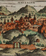

Giuseppe Rosaccio was an Italian physician, astronomer, cosmographer and cartographer.
Rosaccio graduated from the University of Padua, studied philosophy, medicine and law, and worked as a physician and judge. He became famous for a series of works that popularized a number of scientific disciplines. Some of his books deal with astrological medicine, specific diseases and their remedies, and the distillation of medicines from plants.
Giuseppe Rosaccio wrote about forty works on various topics of interest to him, but the main one was geography. He wrote an essay on the Muslim religion and treatises on geography, cosmography, astronomy, and astrology, which became very popular and were repeatedly reprinted.
Rosaccio created many atlases and small-format geographical works. Among his works is Ptolemy's Geography, which contains many indexes and is written in Italian (1599). He also authored a large map of the world (1597), and a large map of Italy and Tuscany (1609). His book Journey from Venice to Constantinople includes maps of the route with brief texts, that is, it is essentially an illustrated version of a pilgrimage to the Holy Land.
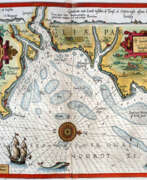

Lucas Waghenaer, full name Lucas Janszoon Waghenaer, was a famous Dutch cartographer, navigator, navigator and writer of the Golden Age.
Between 1550 and 1579, Waghenaer sailed the seas as a senior assistant captain and probably socialized with Portuguese, Spanish, and Italian navigators. The knowledge of nautical charts and the instructions Waghenaer received as a result of these contacts had a great influence on his later work as a cartographer. It is evident that the charts he made had to be based on his observations, and in all his work he had to draw on his own extensive experience of practical navigation. His book Spieghel der Zeevaerdt ("The Navigator's Mirror") or Speculum nauticum super navigatione, first published in 1584, occupies a unique place among the nautical printed works of the sixteenth century, for it is the first printed work with maps.
Moreover, in terms of the magnificent design of the maps and text, it surpasses all other editions of this period and served as a model for pilotage guides and folios with maps even a century later. It is an atlas of nautical charts with instructions for navigation in the western and northwestern coastal waters of Europe. Thanks to the unrivaled skill of engravers Baptiste and Johannes van Deitekom, Waghenaer's original maps were transformed into the most beautiful maps of the time. This book was a huge success, reprinted several times and translated into English, German, Latin and French.
In 1592, Waghenaer's second pilot book Thresoor der zeevaert ("Treasure of Navigation") was published, and in 1598, the third and last publication Enchuyser zeecaertboeck ("Enkhuizen Book of Nautical Charts").
