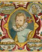
Geographers 17th century
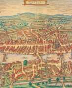

Georg Braun was a German topographical geographer, cartographer and publisher.
Braun was the editor-in-chief of the Civitates orbis terrarum, a groundbreaking atlas of cities, one of the major cartographic achievements of the 16th century. It was the first comprehensive and detailed atlas, with plans of the world's famous cities and bird's-eye views, and became one of the best-selling works of the time.
The book was prepared by Georg Braun in collaboration with the Flemish engraver and cartographer Frans Hoogenberg. Braun, as editor-in-chief, acquired tables, hired artists, and wrote the texts. They drew on existing maps as well as maps based on drawings by the Antwerp artist Joris Hofnagel and his son Jacob. Other authors include Pieter Bruegel the Elder (c. 1525-1569), Jacob van Deventer (c. 1505-1575), and more than a hundred other artists and engravers.
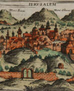

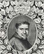
Giuseppe Rosaccio was an Italian physician, astronomer, cosmographer and cartographer.
Rosaccio graduated from the University of Padua, studied philosophy, medicine and law, and worked as a physician and judge. He became famous for a series of works that popularized a number of scientific disciplines. Some of his books deal with astrological medicine, specific diseases and their remedies, and the distillation of medicines from plants.
Giuseppe Rosaccio wrote about forty works on various topics of interest to him, but the main one was geography. He wrote an essay on the Muslim religion and treatises on geography, cosmography, astronomy, and astrology, which became very popular and were repeatedly reprinted.
Rosaccio created many atlases and small-format geographical works. Among his works is Ptolemy's Geography, which contains many indexes and is written in Italian (1599). He also authored a large map of the world (1597), and a large map of Italy and Tuscany (1609). His book Journey from Venice to Constantinople includes maps of the route with brief texts, that is, it is essentially an illustrated version of a pilgrimage to the Holy Land.
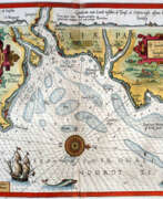

Lucas Waghenaer, full name Lucas Janszoon Waghenaer, was a famous Dutch cartographer, navigator, navigator and writer of the Golden Age.
Between 1550 and 1579, Waghenaer sailed the seas as a senior assistant captain and probably socialized with Portuguese, Spanish, and Italian navigators. The knowledge of nautical charts and the instructions Waghenaer received as a result of these contacts had a great influence on his later work as a cartographer. It is evident that the charts he made had to be based on his observations, and in all his work he had to draw on his own extensive experience of practical navigation. His book Spieghel der Zeevaerdt ("The Navigator's Mirror") or Speculum nauticum super navigatione, first published in 1584, occupies a unique place among the nautical printed works of the sixteenth century, for it is the first printed work with maps.
Moreover, in terms of the magnificent design of the maps and text, it surpasses all other editions of this period and served as a model for pilotage guides and folios with maps even a century later. It is an atlas of nautical charts with instructions for navigation in the western and northwestern coastal waters of Europe. Thanks to the unrivaled skill of engravers Baptiste and Johannes van Deitekom, Waghenaer's original maps were transformed into the most beautiful maps of the time. This book was a huge success, reprinted several times and translated into English, German, Latin and French.
In 1592, Waghenaer's second pilot book Thresoor der zeevaert ("Treasure of Navigation") was published, and in 1598, the third and last publication Enchuyser zeecaertboeck ("Enkhuizen Book of Nautical Charts").
