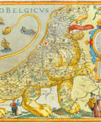
Publishers 17th century
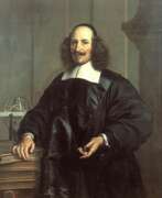

Jan (Joan) Willemsz. Blaeu was a Dutch cartographer, publisher and judge.
Jan was born into the family of the cartographer and publisher Willem Janszoon Blaeu (1571-1638). He studied in Leiden, where he earned a doctorate in law, and in Padua. He then began to assist his father, who was engaged in the manufacture of globes and maps. After his father's death, Jan, together with his brother Cornelius, continued his work, and succeeded him as cartographer for the Dutch East India Company.
In 1651 Blaeu was elected to the Amsterdam city council and later appointed as a judge. At the same time, he was engaged in his publishing business: he continued to publish volumes of Atlas novus, which contained maps of English counties and, for the first time, an atlas of Scotland, as well as one volume of maps of the Far East.
Blaeu did not have time to complete his most ambitious project, but it made him famous as the author of the famous 11-volume Dutch atlas. Based on his previous maps, Blaeu created the Great Atlas (Atlas Maior) - it contained nearly 600 maps and a total of 3,000 pages of Latin text - and was published in 1662. Blaeu's maps were groundbreaking for their time because they were created in accordance with the heliocentric theories of Nicolaus Copernicus.
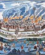
In 1672, a great fire in Amsterdam destroyed Blaeu's workshop, and the cartographer died a year later, apparently never recovering from this stroke of fate.
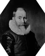

Willem Janszoon Blaeu was a Dutch cartographer and map publisher.
Willem studied astronomy and cartography under the Danish astronomer Tycho Brahe and even discovered the variable star P Swan in 1600. A little later Blaeu settled in Amsterdam, where he began making globes and also began producing land and sea maps, including a 1605 world map. In 1629 he managed to acquire the printing plates of the cartographer Jodok Hondius, with which he published his own atlas.
In 1633, Willem Blaeu was appointed cartographer of the Dutch Republic, as well as the official cartographer of the Dutch East India Company. Blau built up a large collection of maps and conducted an extensive publishing business. After Willem's death, his sons Jan Blaeu (1596-1673) and Cornelius Blaeu successfully continued his work. But in 1672, during a fire in Amsterdam, Blaeu's workshop was destroyed, and the company founded by Willem Blaeu ceased to exist in 1698.
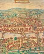

Georg Braun was a German topographical geographer, cartographer and publisher.
Braun was the editor-in-chief of the Civitates orbis terrarum, a groundbreaking atlas of cities, one of the major cartographic achievements of the 16th century. It was the first comprehensive and detailed atlas, with plans of the world's famous cities and bird's-eye views, and became one of the best-selling works of the time.
The book was prepared by Georg Braun in collaboration with the Flemish engraver and cartographer Frans Hoogenberg. Braun, as editor-in-chief, acquired tables, hired artists, and wrote the texts. They drew on existing maps as well as maps based on drawings by the Antwerp artist Joris Hofnagel and his son Jacob. Other authors include Pieter Bruegel the Elder (c. 1525-1569), Jacob van Deventer (c. 1505-1575), and more than a hundred other artists and engravers.
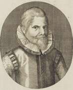

ohann Theodor de Bry (also Johann Dietrich de Bry) was a German publisher, engraver and draughtsman from the Calvinist de Bry family of artists.
Johann was the eldest son and apprentice of the Flemish painter and goldsmith Theodor de Bry (1528-1598). In 1598, Johann Theodor took over the family print shop and moved the business from Frankfurt to Oppenheim. In addition to many of his own works, he greatly added to the collection of "Portraits of Eminent Figures" begun by his father. De Bry specialized in richly illustrated scientific books.
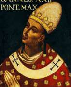

Giuseppe Franco, an Italian painter active between 1565 and 1628, remains an enigmatic figure in the rich tapestry of art history. Known by various names, including Giuseppe Franchi, Giuseppe Monti, and Giuseppe dalle Lodole, his diverse monikers reflect the multifaceted nature of his work and the period's artistic fluidity.
Rooted in the transition from the Renaissance to the Baroque, Franco's artistry is characterized by its dynamic compositions and emotional intensity. While specific details of his oeuvre are less documented, his known works suggest a mastery of form and color, embodying the evolving styles of his time. Franco's paintings, presumably found in Italian churches and private collections, would offer a glimpse into the religious and cultural narratives prevalent during his lifetime.
Franco's contributions to art and culture are significant for their historical context and the light they shed on the period's aesthetic developments. His style, indicative of the early Baroque's emerging vibrancy, would have played a role in the transition from the classical harmony of the Renaissance to the expressive drama of the Baroque.
For collectors and experts in art and antiques, Giuseppe Franco's works represent a fascinating puzzle piece of history, bridging gaps between known artistic milestones. His paintings, if extant, would be prized not only for their beauty but also for their historical value, offering insights into the era's shifting paradigms.
To explore the mystery and beauty of Giuseppe Franco's art and to stay informed about potential discoveries, sales, and auction events related to his work, signing up for updates is recommended. This subscription ensures direct access to the latest information, catering specifically to enthusiasts of historic art and antiques.
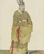

Pierre Giffart was a French painter, printmaker and engraver.
He was a royal engraver and created lithographic works on a variety of subjects. One of Giffart's famous works are plates from original Chinese works brought from China by the envoy of King Louis XIV of France, Joachim Bouvet, depicting graceful Chinese figures in traditional and ceremonial dress. The first French edition of Beauvais's The Historical Portrait of the Emperor of China, with illustrations by Pierre Giffart, was published in Paris in 1697, and was subsequently translated and published in other languages.
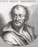

Matthäus Merian the Elder was a Swiss engraver and draftsman, renowned for his detailed and intricate works during the Baroque era. Born in Basel in 1593, he made significant contributions to art, particularly through his engravings and illustrations. Merian's artistic journey led him to Frankfurt am Main, where he produced a plethora of engravings depicting various subjects, including battles, hunts, and topographic views of European towns.
One of his notable contributions is his work on "Theatrum Europaeum," a series that chronicled contemporary history. Merian's legacy continued through his family, with his children, particularly Matthäus Merian Jr. and Caspar, taking over his publishing house after his death in 1650. They preserved and extended their father's artistic heritage, continuing to publish significant works like the "Topographia Germaniae."
Matthäus Merian the Elder's artistry was not confined to historical and topographical subjects; he also excelled in creating alchemical illustrations, demonstrating his versatility and depth as an artist. His works, such as those found in the "Musaeum Hermeticum" and "Atalanta Fugiens," display the finesse and detail that characterize his style. Today, Merian's works are preserved in various museums and collections, offering a window into the artistic and cultural milieu of the 17th century.
For collectors and experts in art and antiques, Merian's works represent a significant chapter in the history of engraving and illustration, reflecting the rich cultural and historical narratives of his time. If you are keen on exploring more about Matthäus Merian the Elder's contributions to art and history, consider signing up for updates on sales and auction events related to his works.
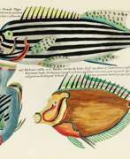

Louis Renard was a Dutch painter, printmaker and book publisher born in France.
Renard published map atlases and illustrated works of natural history popular in 18th-century Europe. In Amsterdam he acquired many cartographic plates by Frederick de Wit, which he combined with minor updates and corrections into an Atlas of Navigation and Commerce and published in 1715. He later sold the plates to R. & J. Ottens, who republished it in 1745.
In 1718 -1719 Renard published the first edition of his most famous multi-volume work, Poissons, écrevisses et crabes... que l'on trouve autour des Isles Moluques, et sur les cotes des Terres Australes ("Fish, crayfish and crabs, of varied colors and unusual forms, which are found around the Moluccas Islands and on the coasts of the southern lands."). This book was the world's first encyclopedia of fish illustrated in color. While working on it, Renard copied drawings by other artists, notably the talented Dutch artist Samuel Fallors. The result was 460 hand-colored copperplate prints.
The creatures in Renard's book are so fanciful that they may seem fictional, but only about 10 percent are, including the depiction of a mermaid. Most likely, these fantasies were included for the sake of attracting buyers. The work is now believed to be an important part of eighteenth-century scientific literature.
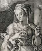

Crispijn van de Passe the Elder was a Netherlandish engraver and publisher, renowned for his intricate and evocative engravings that spanned various subjects, including portraits, historical scenes, and mythological tales. His work contributed significantly to the art and culture of the time, capturing the complexities of human emotions and narratives in his prints.
Noteworthy is his engraving of Queen Elizabeth I, which highlights his proficiency in portraiture, illustrating the regal demeanor and significance of the English monarch in 1592. His series on "The Muses," specifically the depiction of Euterpe, showcases his skill in combining engraving with etching to portray the grace and inspiration associated with the muses of classical mythology. Furthermore, his work on "Liber Genesis," particularly "Aftermath of the Flood," demonstrates his ability to convey powerful biblical stories through his artistry.
Crispijn's family, including his children, continued his legacy in engraving, contributing to the family's reputation in the art world. His works are held in prestigious institutions worldwide, such as The Metropolitan Museum of Art in New York and the Rijksmuseum in Amsterdam, underscoring their enduring appeal and significance in the history of art.
For collectors and experts in art and antiques, Crispijn van de Passe the Elder's engravings offer a glimpse into the artistic endeavors of the 16th and 17th centuries, reflecting the cultural and historical contexts of the time. To stay updated on sales and auction events featuring his works, consider signing up for updates, ensuring access to the latest offerings related to this distinguished artist's creations.
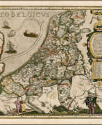

Pieter van der Keere (Latin: Petrus Kaerius) was a Flemish engraver, publisher, cartographer and globe maker.
His father was the master of typefaces Hendrik van der Keere (c. 1540-1580); in 1584 he fled from the Netherlands to London, where he lived most of his life. Pieter van der Keere produced engravings and atlases. From 1603, Kere began to produce large city panoramas, including Utrecht, Cologne, Amsterdam and Paris.
An atlas of the Netherlands was published in 1617, with der Keere's name as publisher and his full signature on several maps. He also produced topographical maps of Amsterdam and Nuremberg, as well as a world map ("Nova totius terrarum orbis..."), which was printed by Jan Janszoon in Amsterdam.
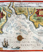

Lucas Waghenaer, full name Lucas Janszoon Waghenaer, was a famous Dutch cartographer, navigator, navigator and writer of the Golden Age.
Between 1550 and 1579, Waghenaer sailed the seas as a senior assistant captain and probably socialized with Portuguese, Spanish, and Italian navigators. The knowledge of nautical charts and the instructions Waghenaer received as a result of these contacts had a great influence on his later work as a cartographer. It is evident that the charts he made had to be based on his observations, and in all his work he had to draw on his own extensive experience of practical navigation. His book Spieghel der Zeevaerdt ("The Navigator's Mirror") or Speculum nauticum super navigatione, first published in 1584, occupies a unique place among the nautical printed works of the sixteenth century, for it is the first printed work with maps.
Moreover, in terms of the magnificent design of the maps and text, it surpasses all other editions of this period and served as a model for pilotage guides and folios with maps even a century later. It is an atlas of nautical charts with instructions for navigation in the western and northwestern coastal waters of Europe. Thanks to the unrivaled skill of engravers Baptiste and Johannes van Deitekom, Waghenaer's original maps were transformed into the most beautiful maps of the time. This book was a huge success, reprinted several times and translated into English, German, Latin and French.
In 1592, Waghenaer's second pilot book Thresoor der zeevaert ("Treasure of Navigation") was published, and in 1598, the third and last publication Enchuyser zeecaertboeck ("Enkhuizen Book of Nautical Charts").
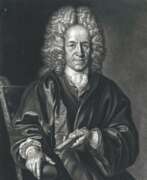

Christoph Weigel the Elder, full name Johann Christoph Weigel, was a German painter, engraver and publisher.
Weigel worked very successfully in the mezzotint technique. He was the first engraver to use a kind of machine for making backgrounds. He established his own printing house in Nuremberg in 1698, and worked closely with the imperial geographer and cartographer Johann Baptist Homann (1664-1724) to produce his maps. His younger brother Johann Christoph Weigel kept an art trade store in Nuremberg around the same time, and also quite successfully.
One of Weigel's most important works is the Ständebuch (Book of Classes) of 1698, which describes and illustrates with engravings more than two hundred trades and services, including mining.
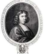

Michael Wening was a Bavarian artist, engraver and publisher of the Baroque period.
Wening was court engraver to Elector Ferdinand Maria of Bavaria and his successor Elector Max Emanuel. By the end of the 1670s, he opened his own publishing house, where he successfully published illustrated calendars and then topographical and historical materials for more than a decade.
Wening's main work - "Historico-Topographical Description" with 846 views - is considered the most complete description of Europe in the early modern period. To create it, the master himself traveled to many cities and made very accurate illustrations. The topographical work includes views and descriptions of towns, markets, monasteries, palaces, castles, court marks, and estates in Bavaria. The accompanying texts, which are a valuable addition to the engravings, were written by the Jesuit Ferdinand Schönwetter.
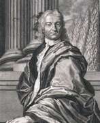

Jeremias Wolff was a German engraver and publisher.
Wolff was an engraver and watchmaker, but managed to create in Augsburg the largest art publishing house of the first half of the 18th century, which employed the best engravers of his time. The workshop, most often under Wolff's own name, produced maps and popular copperplate engravings. Among them is an album with illustrations of costumes of the Ottoman Empire, Germany, Switzerland, France and Turkey in the 18th century.
On the initiative of Jeremias Wolff, the Imperial City Art Academy was founded in Augsburg in 1710.
