Cartographers 19th century
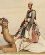

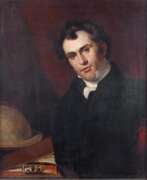
Robert Baikie was a Scottish-born physician, writer and artist.
Baikie spent more than 17 years as a doctor in India with the East India Company's Madras Army, as Chief Medical Officer of the Nilgiris, and has written extensively about the region. It is a fascinating account of the Nilgiri Mountains with maps of the hills and approaches to them, sketches of the scenery, drawings of the principal buildings and tables of routes. This work by Robert Baikie was later published as Observations on the Nilgiri, including an account of their topography, climate, soil and produce.
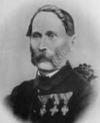

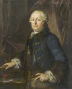
Joseph Georg Böhm was an Austrian astronomer, astrophysicist, cartographer, mathematician, and educator.
At the University of Prague, Böhm attended lectures in mathematics, physics, astronomy, and, after receiving his doctorate, became an assistant at the Vienna Observatory under Joseph Johann von Littrow. He then worked at the observatory at Othen and taught mathematics at the University of Salzburg. In 1839 he was appointed professor of mathematics and practical geometry at the University of Innsbruck, and in 1848 he was elected its rector. In 1852 Böhm was appointed director of the Prague Observatory and professor of theoretical and practical astronomy at the University of Prague.
Georg Böhm published several significant astronomical papers on solar observation. He is the creator of several instruments for astronomical measurements and observations, and he designed the Uranoscope and Universal Gnomon for amateur astronomical observations for the general public. As a member of the commission for the repair of the Prague Astronomical Clock, which he joined in 1865, he wrote a detailed description of it in the work Beschreibung der alterthümlichen Prager Rathausuhr. In addition to astronomy and its popularization, he was also involved in agriculture, economics, and geodesy. One of his important works is Ballistic Experiments (1865).
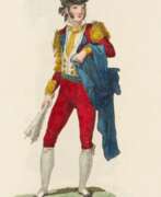

Juan Carrafa was a Spanish cartographer and engraver who worked in Madrid in the 19th century.
He was educated at the Academy of Fine Arts of San Fernando. Among others, Juan Carrafa is known for a large work of more than one hundred engravings depicting the Spanish costume of various regions of Spain, which he produced from drawings by the artist José Ribelles (1778-1835). The prints depict a variety of professions, including bullfighters, gypsies, sailors, merchants, fishermen, students, porters, etc. The selection was published in Real Calcografía from 1825.
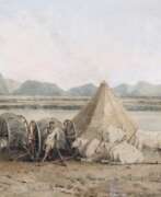

John Gantz was an Austrian-born architect, painter, surveyor and lithographer.
Gantz worked for the East India Company from about 1800 to 1803 as a draftsman and architect. A manuscript list of Madras residents dated March 1819 lists him as "Architect, originally from India". By 1827, Gantz had installed the first lithographic printing press in Madras, one of the first such printing presses in India. Gantz's drawings depict the bridges and architectural structures of the city, the inhabitants in their daily activities, modes of transportation, crafts and professions of Indians, he also painted picturesque landscapes of India.
Gantz had two sons, architect Justinian and Julius.
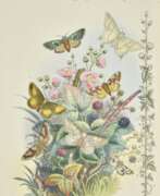

Paul Jerrard was a British artist, illustrator, cartographer and publisher.
His publishing house, Jerrard & Son, Paul & Son, produced Shakespearean paintings, ornithological, entomological and botanical publications, species, sheet music, gift books, almanacs etc.
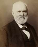

Heinrich Kiepert, full name Johann Samuel Heinrich Kiepert, was a German geographer and cartographer.
Kiepert is considered one of the most important map scholars of the second half of the 19th century. Educated at the University of Berlin, Kiepert worked with Karl Ritter (1779-1859). Together they produced one of the first modern atlases of the ancient Greek world, the Topographical-Historical Atlas of Hellas and the Hellenic Colonies in 24 sheets (1840-1846). He traveled to Asia Minor and produced two maps of the region in 1844.
Heinrich Kiepert also taught geography at the Humboldt University-Berlin for 40 years and was a member of the Prussian and Austrian Academies of Sciences.
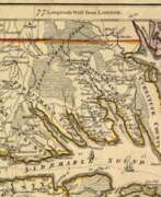

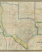
William Henry Mouzon, Jr. was an American cartographer and civil engineer.
Henry Mouzon, Jr. was the grandson of a Huguenot immigrant and was sent to France at the age of eight, where he was trained as a civil engineer and surveyor. In 1771 he and Ephraim Mitchell were sent to survey the boundaries of South Carolina. As a result, a map was created and published in 1775 that included both North and South Carolina with corrections to previous maps.
This map was entitled "An Accurate Map of North and South Carolina with their Indian Boundaries," and clearly showed all the mountains, rivers, swamps, marshes, bogs, bays, creeks, harbors, sandbanks and shoals on the coasts, and gave the names of the land owners. American, British, and French troops used this map during the American Revolution. A copy of this map, owned by George Washington, is now in the library of the American Geographical Society.
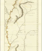

John Ross was an American military cartographer and surveyor.
Lieutenant John Ross served as a surveyor in the 34th Regiment of the British Army. After the Treaty of Paris in 1763, a British expedition was sent into Illinois Territory to demand the surrender of Fort de Chartres, the last outpost under French control in the area. John Ross traveled with this expedition, surveyed the lower river to the mouth of the Mississippi River, and created a unique map. It was titled "The Course of the Mississippi River from Balise to Fort Chartres; taken on an Expedition to Illinois" and published in London in 1775.
Lieutenant Ross's large-scale map of the Mississippi River is one of the few large format maps of the Mississippi published in the 18th century. Ross's map was the first official English survey of the Lower Mississippi and one of the most historically significant American maps. It delineated British territorial acquisitions after the French and Indian War and then established the future western boundary of the new United States. The map opened the territory to settlement from the east and defined the western boundaries of the American colonies.
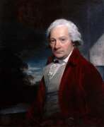

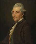
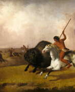
Paul Sandby was a British watercolorist, draughtsman and printmaker, and a founder member of the Royal Academy.
Sandby first worked as a draughtsman and cartographer before painting his first paintings, watercolors of bridges, fortifications and Scottish landscapes, as well as views of Windsor. These works eventually made him a sought-after artist. Sandby also painted many caricatures and skillfully documented eighteenth-century British social life.
In 1768, Sandby, his brother Thomas Sandby and 27 other artists became founding members of the Royal Academy in London. He is now considered one of the founders of English watercolor.
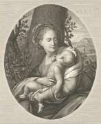

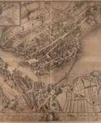
Johann Carl Schleich the Elder was a German engraver. On the basis of paintings he created engraving portraits of famous contemporaries, made topographical works. His son, Johann Carl Schleich the Younger, was also an engraver.
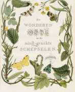

Jan Christiaan Sepp was a Dutch book publisher, printmaker and illustrator.
Jan Christiaan Sepp belonged to a dynasty of collectors, publishers and traders in printed books founded by his father, Christian Sepp (c. 1700-1775) in Goslar, Germany. Jan Christian Sepp is known for being the chief illustrator, creating the magnificent engravings for Cornelius Nozeman's highly prized work entitled Nederlandsche Vogelen (Birds of the Netherlands, 1770-1829). These copperplate engravings, superbly composed, meticulously engraved and hand-colored are of great value.
After Christian Sepp's death, the work of illustrating the five volumes was completed by his son, Jan Sepp. Each volume of this five-volume work of science and art contains 50 images of bird species, and each species is described on several pages.
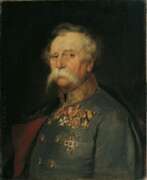

Franz Edler von Hauslab or Franz Ritter von Hauslab was an Austrian military commander, military educator, cartographer, geologist and artist.
He graduated from the engineering academy and then taught at it, achieving great success in topography and cartography. During the Austro-Italian-French War in 1859 he commanded artillery.
Von Hauslab was engaged in geological research and published several scientific works. He introduced a number of innovations in Austrian cartography, such as creating a color scale for contour lines on maps and introducing color lithography to cartography. Von Hauslab was a member of many learned societies.
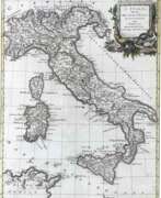

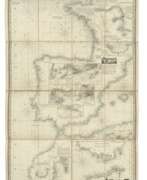
Antonio Zatta was an Italian cartographer and publisher who was based in Venice. He may have lived from 1722 to 1804. One of his major contributions include the Atlante Novissimo, a four volume atlas of the world. He also published an edition of the plays of Goldoni with engravings in 1789.
