Geographers 19th century
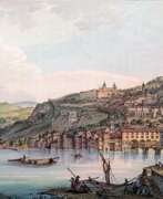

Jean-François Albanis Beaumont was a French landscape painter, engineer, traveler and geographer.
He studied engineering in Paris and worked on architectural structures at Chambérly. Beaumont later accompanied the Duke of Gloucester, William Frederick of Hanover on a grand tour of Germany, Italy, France, and Switzerland, making notes and detailed pictorial sketches of views along the way. In 1800 he published the illustrated books Journey to the Lepontine Alps from France to Italy and Description of the Grecian and Cottian Alps (1802 and 1806).

Edward Wedlake Brayley was a British writer, historian, archaeologist and topographer.
Notable among Brayley's works are A Topographical History of Surrey, Lambeth Palace, Topographical Sketches of Brighthelmston, and Londiniana. Braley often collaborated with the topographer and antiquarian John Britton in the creation of his books. The text in his books was illustrated with woodcuts and engraved steel plates.
Britton and Brayley's long-standing collaboration also resulted in the popular series "Beauties of England and Wales," published from 1801 to 1818. Several volumes were planned, dealing with the history and topography of England and Wales, illustrated with views of picturesque scenes and important places. The series eventually expanded to twenty-five large volumes, published over a period of nearly twenty years.
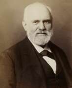

Heinrich Kiepert, full name Johann Samuel Heinrich Kiepert, was a German geographer and cartographer.
Kiepert is considered one of the most important map scholars of the second half of the 19th century. Educated at the University of Berlin, Kiepert worked with Karl Ritter (1779-1859). Together they produced one of the first modern atlases of the ancient Greek world, the Topographical-Historical Atlas of Hellas and the Hellenic Colonies in 24 sheets (1840-1846). He traveled to Asia Minor and produced two maps of the region in 1844.
Heinrich Kiepert also taught geography at the Humboldt University-Berlin for 40 years and was a member of the Prussian and Austrian Academies of Sciences.
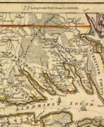

William Henry Mouzon, Jr. was an American cartographer and civil engineer.
Henry Mouzon, Jr. was the grandson of a Huguenot immigrant and was sent to France at the age of eight, where he was trained as a civil engineer and surveyor. In 1771 he and Ephraim Mitchell were sent to survey the boundaries of South Carolina. As a result, a map was created and published in 1775 that included both North and South Carolina with corrections to previous maps.
This map was entitled "An Accurate Map of North and South Carolina with their Indian Boundaries," and clearly showed all the mountains, rivers, swamps, marshes, bogs, bays, creeks, harbors, sandbanks and shoals on the coasts, and gave the names of the land owners. American, British, and French troops used this map during the American Revolution. A copy of this map, owned by George Washington, is now in the library of the American Geographical Society.
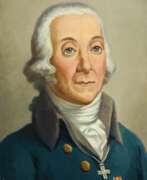

Peter Simon Pállas was a German and Russian scientist-encyclopedist, naturalist and traveler, who gave almost all his life to the service of Russia.
The breadth of his scientific interests made him a true encyclopedist, but he was particularly interested in natural sciences. By the age of 25, Pallas had already acquired European fame as a major scientist-naturalist. At the same time he received an invitation from the St. Petersburg Academy of Sciences, where he was offered a professorship. In 1767, Pallas arrived in St. Petersburg with his wife and soon led several important expeditions to Siberia and southern Russia. In his numerous ethnographic descriptions, the scientist was the first to report in detail on the Kalmyks, Tatars, Mordvins, Chuvashs, Nagaians, Tungus (Evenks), Votyaks (Udmurts), and Cheremis (Mari). In addition, he brought with him large natural-scientific collections. Later he traveled with scientific expeditions to Kamchatka, the Kuril Islands, Crimea and other previously unexplored lands.
In 1785 Catherine II attracted Pallas to the collection and comparative analysis of the languages of the peoples inhabiting America, Asia, Europe and Russia, and he compiled and published a comparative dictionary in two parts (1787-1789), in which more than 200 languages and dialects of the peoples of Asia and Europe were presented. In the last years of his life, among other things, Pallas was engaged in the preparation of a fundamental three-volume work on the fauna of Russia, Zoographia rosso-asiatica ("Russian-Asiatic Zoology"), in which more than 900 species of vertebrates, including 151 species of mammals, of which about 50 new species were introduced. This work was so extensive, and the descriptions of the animals were so thorough and detailed, that until the early 20th century the book remained the main source of knowledge about the fauna of Russia. In 1810. Peter Pallas went to Berlin to prepare illustrations for this work, but a year later the famous scientist died and was buried in Berlin.
A volcano in the Kuril Islands, a reef off New Guinea, and many animals and plants are named after Pallas.
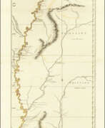

John Ross was an American military cartographer and surveyor.
Lieutenant John Ross served as a surveyor in the 34th Regiment of the British Army. After the Treaty of Paris in 1763, a British expedition was sent into Illinois Territory to demand the surrender of Fort de Chartres, the last outpost under French control in the area. John Ross traveled with this expedition, surveyed the lower river to the mouth of the Mississippi River, and created a unique map. It was titled "The Course of the Mississippi River from Balise to Fort Chartres; taken on an Expedition to Illinois" and published in London in 1775.
Lieutenant Ross's large-scale map of the Mississippi River is one of the few large format maps of the Mississippi published in the 18th century. Ross's map was the first official English survey of the Lower Mississippi and one of the most historically significant American maps. It delineated British territorial acquisitions after the French and Indian War and then established the future western boundary of the new United States. The map opened the territory to settlement from the east and defined the western boundaries of the American colonies.
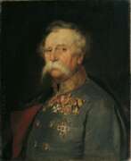

Franz Edler von Hauslab or Franz Ritter von Hauslab was an Austrian military commander, military educator, cartographer, geologist and artist.
He graduated from the engineering academy and then taught at it, achieving great success in topography and cartography. During the Austro-Italian-French War in 1859 he commanded artillery.
Von Hauslab was engaged in geological research and published several scientific works. He introduced a number of innovations in Austrian cartography, such as creating a color scale for contour lines on maps and introducing color lithography to cartography. Von Hauslab was a member of many learned societies.
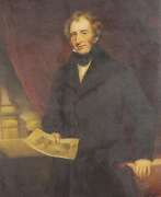

Isaac Weld was an Irish explorer, writer, and artist.
After completing his studies, Isaac Weld traveled to the new lands of America in 1795, meeting Thomas Jefferson and George Washington. The purpose of his journey was to learn of opportunities for Irish resettlement. Returning in 1797, Weld soon published his book, A Journey through the States of North America and the Provinces of Upper and Lower Canada. In general, Weld did not like the United States; he particularly noted the practice of slavery and the treatment of Native peoples by the rude new Americans. But he liked Canada and Quebec: he praised the views from the Citadel and reported that because of the low cost of land, a middle-income person could easily settle in the country for himself and his family.
This book by Weld was quite popular: it went through several editions from its first publication in 1799 to 1807. By 1820, it had also been translated into French, German, Italian, and Dutch.
In 1800 Weld was elected a member of the Royal Society of Dublin. In 1811 and 1812 he served on the library committee, and on December 4, 1828, he was elected honorary secretary. His first act in this capacity was to establish an annual exhibition of specimens of the manufactures and products of Ireland. Isaac Weld published several other books on Ireland and Great Britain, illustrated with his own drawings. Of these, his Statistical Survey of the County of Roscommon, over seven hundred pages long, published by the Royal Dublin Society in 1832, stands out.
