ID 1032977
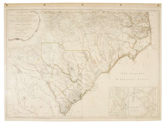
Lot 318 | Mouzon's Map of the Carolinas
Estimate value
$ 4 000 – 6 000
The most important map of the Carolinas, "the archetype for plotting out that region for almost fifty years" Schwartz & Ehrenburg. This is the second state of three, identical to the first state except with the addition of Fort Sullivan to the inset of Charlestown. The map originally "appeared on the eve of the American Revolution, and its up-to-date geography made it the most widely consulted map of the area used in the war effort" (Pritchard & Taliaferro). George Washington’s copy of this 1776 issue, folded and mounted on cloth, resides in the collection of the American Geographical Society. Cumming, Southeast in Early Maps 450; Pritchard & Taliaferro, Degrees of Latitude 44; Schwartz & Ehrenberg, Mapping of America pl. 115.
Engraved map hand-colored in outline comprising four engraved and joined sheets, large engraved cartouche upper left, two inset maps lower right, together approximately 1065 x 1460mm (42 x 57.5 inches) sheet size (top edge hinged to later paper panel with grommets, repaired 2" tear at upper left).
| Artist: | Henry Mouzon II (1741 - 1807) |
|---|---|
| Place of origin: | United Kingdom |
| Auction house category: | Maps & Atlases |
| Artist: | Henry Mouzon II (1741 - 1807) |
|---|---|
| Place of origin: | United Kingdom |
| Auction house category: | Maps & Atlases |
| Address of auction |
CHRISTIE'S 20 Rockefeller Plaza 10020 New York USA | ||||||||||||||
|---|---|---|---|---|---|---|---|---|---|---|---|---|---|---|---|
| Preview |
| ||||||||||||||
| Phone | +1 212 636 2000 | ||||||||||||||
| Fax | +1 212 636 4930 | ||||||||||||||
| Conditions of purchase | Conditions of purchase | ||||||||||||||
| Shipping |
Postal service Courier service pickup by yourself | ||||||||||||||
| Payment methods |
Wire Transfer | ||||||||||||||
| Business hours | Business hours
|


