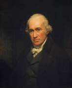
Engineers 19th century
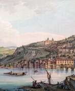

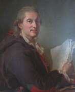
Jean-François Albanis Beaumont was a French landscape painter, engineer, traveler and geographer.
He studied engineering in Paris and worked on architectural structures at Chambérly. Beaumont later accompanied the Duke of Gloucester, William Frederick of Hanover on a grand tour of Germany, Italy, France, and Switzerland, making notes and detailed pictorial sketches of views along the way. In 1800 he published the illustrated books Journey to the Lepontine Alps from France to Italy and Description of the Grecian and Cottian Alps (1802 and 1806).
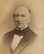

Augustin Louis Cauchy was a French mathematician and mechanic, military engineer, and founder of mathematical analysis.
Cauchy studied at the École Polytechnique and at the Paris School of Bridges and Roads. After becoming a military engineer, he went to Cherbourg in 1810 to work on harbors and fortifications for Napoleon's English invasion. Here he began independent mathematical research. Cauchy returned to Paris in 1813, and Lagrange and Laplace convinced him to devote himself entirely to mathematics. The following year he published a memoir on definite integrals, which formed the basis of the theory of complex functions. From 1816, Cauchy held professorships at the Faculty of Natural Sciences, the Collège de France, and the École Polytechnique in Paris.
Cauchy developed the foundation of mathematical analysis, and made enormous contributions to analysis, algebra, mathematical physics, and many other areas of mathematics. He almost single-handedly founded the theory of functions of a complex variable, which has extensive applications in physics. Cauchy's greatest contributions to mathematics are published primarily in three of his treatises, "Courses in Analysis at the Royal Polytechnic School" (1821), "Summary of Lessons on Infinitesimal Calculus" (1823), and "Lessons on the Application of Infinitesimal Values in Geometry" (1826-28). In all, Augustin Louis Cauchy wrote about 800 scientific articles.
Cauchy was a member of the Paris Academy of Sciences, the Royal Society of London, the St. Petersburg Academy of Sciences, and other academies.
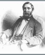

Everhardus Koster, a notable Dutch painter, left an indelible mark in the realm of art with his specialization in sea and river scenes. His artistic journey, beginning from an early age, was initially overshadowed by practical decisions that led him towards marine engineering. However, his undeniable talent for drawing, particularly his attraction to merchant ships, caught the eye of Bartholomeus Johannes van Hove, the director of the Royal Academy of Art. Van Hove's encouragement steered Koster towards a path in painting, ultimately shaping his artistic destiny.
Everhardus Koster's education at the Royal Academy of Art was a pivotal point in his career. Following his studies, he moved to Frankfurt, where he honed his skills by studying the Old Masters at the Städel and attending classes at the Städelschule. His proficiency in painting was evident as he established a successful studio in Amsterdam and was elected a member of the Rijksakademie in 1852. A significant milestone in his career was his appointment as a curator at the Villa Welgelegen in 1858.
Despite suffering a personal setback in 1859 when he lost his right eye in an accident, Everhardus Koster's resilience and passion for art enabled him to continue painting. He navigated through his artistic endeavors with a sense of determination, even amidst complaints and challenges related to the methods of art preservation and storage at the Villa Welgelegen. These issues eventually led to improvements and the relocation of parts of the collection to the Rijksmuseum.
Koster's later years saw him moving back to The Hague and finally settling in Dordrecht, where he continued to paint until his death on January 8, 1892. His legacy as a Dutch painter specializing in maritime subjects is etched in the annals of art history, reminding us of the serene beauty of sea and river landscapes.
For collectors and art enthusiasts, the works of Everhardus Koster represent a bygone era of Dutch painting, capturing the essence of maritime life and landscapes with a masterful touch. His art remains a source of inspiration and admiration, reflecting the tranquility and dynamic nature of water scenes.
If you are keen on exploring more about Everhardus Koster and wish to receive updates on sales and auction events related to his works, consider signing up for our updates. Stay informed and be part of a community that appreciates the profound beauty and historical significance of Koster's art.
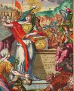

Arsène Lacarrière Latour, full name Géraud Calixte Jean Baptiste Arsène Lacarrière Latour, was a French-born American engineer and military officer, architect and surveyor, and writer.
He studied architecture and engineering at the Académie des Beaux-Arts in Paris and served briefly in the French Army Corps of Engineers. In 1805 Latour came to New York, where he worked first as a merchant, then as an architect and surveyor, and opened an architectural firm in New Orleans. In 1812. Latour became a U.S. citizen.
In 1814. Latour became Andrew Jackson's military engineer and made an important contribution to the American victory at the Battle of New Orleans. After the war ended, Latour published a book, Historical Memoirs of the War in West Florida and Louisiana, 1814-1815, which is still valued for its eye-witness view of the war.
In 1816. Latour traveled with Jean Lafitte on an expedition to survey and map the Southwest as an agent for Spain. From 1818 to 1834 he worked as an architect in Havana. His manuscripts include an extensive report describing Havana's thriving economy in 1815-1821, local agricultural production (sugar cane, coffee, tobacco), trade with Europe, the United States, and the colonies of South America; statistics; and a section on the city's possible future expansion and growth. Latour subsequently returned to France, where he died.

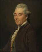
William Henry Mouzon, Jr. was an American cartographer and civil engineer.
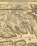
Henry Mouzon, Jr. was the grandson of a Huguenot immigrant and was sent to France at the age of eight, where he was trained as a civil engineer and surveyor. In 1771 he and Ephraim Mitchell were sent to survey the boundaries of South Carolina. As a result, a map was created and published in 1775 that included both North and South Carolina with corrections to previous maps.
This map was entitled "An Accurate Map of North and South Carolina with their Indian Boundaries," and clearly showed all the mountains, rivers, swamps, marshes, bogs, bays, creeks, harbors, sandbanks and shoals on the coasts, and gave the names of the land owners. American, British, and French troops used this map during the American Revolution. A copy of this map, owned by George Washington, is now in the library of the American Geographical Society.
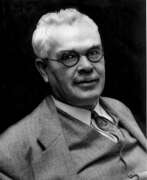

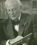
Francis Gladheim Pease was an American astronomer and optical instrument maker.
Pease graduated from the Armor Institute of Technology in Chicago, worked as an optician and observer at Yerkes Observatory, and from 1904 also made optical instruments at Mount Wilson Observatory, where he worked for 34 years. Pease designed a 100-inch telescope as well as a 50-foot interferometric telescope, with which he made direct measurements of the diameters of stars. He also participated in the development of the Hale telescope.
In 1928 he found the first planetary nebula in a globular cluster (M15), now cataloged as Pease. Francis Gladheim Pease also took very high quality photographs of the surface of the Moon, and a crater on this Earth satellite is named in his honor.

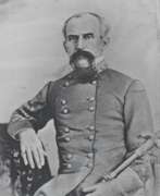
John Ross was an American military cartographer and surveyor.
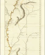
Lieutenant John Ross served as a surveyor in the 34th Regiment of the British Army. After the Treaty of Paris in 1763, a British expedition was sent into Illinois Territory to demand the surrender of Fort de Chartres, the last outpost under French control in the area. John Ross traveled with this expedition, surveyed the lower river to the mouth of the Mississippi River, and created a unique map. It was titled "The Course of the Mississippi River from Balise to Fort Chartres; taken on an Expedition to Illinois" and published in London in 1775.
Lieutenant Ross's large-scale map of the Mississippi River is one of the few large format maps of the Mississippi published in the 18th century. Ross's map was the first official English survey of the Lower Mississippi and one of the most historically significant American maps. It delineated British territorial acquisitions after the French and Indian War and then established the future western boundary of the new United States. The map opened the territory to settlement from the east and defined the western boundaries of the American colonies.
