Geographers
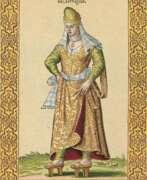

Nicolas de Nicolay, Sieur d'Arfeville & de Belair was a French geographer and artist.
He traveled in Germany, Denmark, England, Sweden, Italy, Spain, Greece and Turkey and served in the armies of most of these countries. Nicholas was the king's geographer, and in 1551 Henry II sent him to Constantinople to work on the d'Aramont embassy. This enabled Nicolas to see a world hitherto virtually unknown in the West. As a result of his work, Nicolas published Travels in Turkey (1567), which depicts the costumes of the peoples of the Middle East, representatives of various nationalities and ethnicities, including Turks, Greeks, Armenians, Jews, and pilgrims to Mecca.
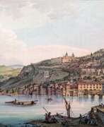

Jean-François Albanis Beaumont was a French landscape painter, engineer, traveler and geographer.
He studied engineering in Paris and worked on architectural structures at Chambérly. Beaumont later accompanied the Duke of Gloucester, William Frederick of Hanover on a grand tour of Germany, Italy, France, and Switzerland, making notes and detailed pictorial sketches of views along the way. In 1800 he published the illustrated books Journey to the Lepontine Alps from France to Italy and Description of the Grecian and Cottian Alps (1802 and 1806).
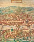

Georg Braun was a German topographical geographer, cartographer and publisher.
Braun was the editor-in-chief of the Civitates orbis terrarum, a groundbreaking atlas of cities, one of the major cartographic achievements of the 16th century. It was the first comprehensive and detailed atlas, with plans of the world's famous cities and bird's-eye views, and became one of the best-selling works of the time.
The book was prepared by Georg Braun in collaboration with the Flemish engraver and cartographer Frans Hoogenberg. Braun, as editor-in-chief, acquired tables, hired artists, and wrote the texts. They drew on existing maps as well as maps based on drawings by the Antwerp artist Joris Hofnagel and his son Jacob. Other authors include Pieter Bruegel the Elder (c. 1525-1569), Jacob van Deventer (c. 1505-1575), and more than a hundred other artists and engravers.
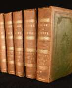

Edward Wedlake Brayley was a British writer, historian, archaeologist and topographer.
Notable among Brayley's works are A Topographical History of Surrey, Lambeth Palace, Topographical Sketches of Brighthelmston, and Londiniana. Braley often collaborated with the topographer and antiquarian John Britton in the creation of his books. The text in his books was illustrated with woodcuts and engraved steel plates.
Britton and Brayley's long-standing collaboration also resulted in the popular series "Beauties of England and Wales," published from 1801 to 1818. Several volumes were planned, dealing with the history and topography of England and Wales, illustrated with views of picturesque scenes and important places. The series eventually expanded to twenty-five large volumes, published over a period of nearly twenty years.
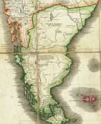

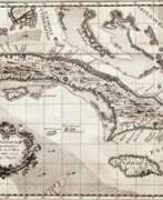
Juan de la Cruz Cano y Olmedilla was a Spanish artist, engraver, and cartographer of the Enlightenment.
Using the most accurate cartographic calculations and methods in the 18th century, he created many geographic maps of Africa and South America, the Strait of Magellan, and others. While in the service of King Carlos III of Spain for many years, Olmedilla mapped Spain and Spanish possessions in Latin America.
Olmedilla also created a multi-volume work devoted to Spanish costume. This collection recorded the various outfits worn by Spaniards, both common and noble, covering all regions of the country and all of its colonies. The topographical and architectural details included in the plates provide additional insight into the mores and geographical features of the various cities and towns depicted. The work was first published in Madrid between 1777 and 1788. These engravings proved incredibly popular and were reprinted in both France and Germany.
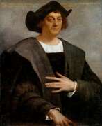

Christopher Columbus (Spanish: Cristóbal Colón, Latin: Christophorus Columbus, Italian: Cristoforo Colombo) was a medieval Spanish navigator of Italian origin who discovered the New World in 1492.
About the exact origin of Columbus scientists argue to this day. He already from his youth had a brilliant knowledge of mathematics, knew several languages, including Latin. Columbus was familiar with the teachings of ancient Greek philosophers and thinkers who depicted the Earth as a sphere, not flat, as was believed in the Middle Ages. Christopher was also trained in the art of navigation and made his first voyages as a young man in the Mediterranean Sea, later sailing to Africa and participating in a northern expedition through the British Isles and Iceland.
Gaining experience, studying geography and maps, Columbus assumed that it was possible to reach India by the western route. He sought financial support from European monarchs, but only the Spanish monarch was interested in the prospects. He agreed and borrowed money to outfit a squadron of ships to find a western route to India.
Christopher Columbus made four historic voyages to the shores of America: August 3, 1492 - March 15, 1493; September 25, 1493 - June 11, 1496; May 30, 1498 - November 25, 1500 and May 9, 1502 - November 7, 1504. Expeditions of Columbus for the first time made information about the lands in the west common knowledge and began the colonization of America by Europeans. But the discoverer of new lands to the end of his life was convinced that he had discovered the richest Western India.
From the last expedition Columbus returned to Spain terminally ill, his last money he spent to pay debts to its participants. Two years later, the discoverer of the New World died in poverty in a small house. Columbus's discoveries, accompanied by the colonization of land, the establishment of Spanish settlements, enslavement and mass extermination of the indigenous population, which he called Indians, were of world significance.
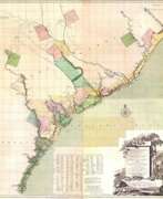

Johann Wilhelm Gerhard von Brahm, also known as John William Gerard de Brahm, was a German cartographer, military engineer, and surveyor who worked for Great Britain to develop the lands of the New World.
His father was court musician to the Elector of Trier and gave his son an excellent early education. After a successful career as a military engineer in the Bavarian army, de Brahm traveled to Georgia in 1751 at the head of a group of German emigrants. There he displayed his talents as a surveyor and engineer, worked as a cartographer, and was commissioned by South Carolina Governor James Glen to design and build a system of fortifications for Charleston.
In 1755 de Brahm was appointed inspector general of lands for South Carolina and soon for the entire New World. He settled in St. Augustine, where he spent the next six years researching and preparing maps. His major works, "Map of South Carolina" and "Map of South Carolina and Part of Georgia," provide detailed topography and even describe underwater features. And his "Report of a General Survey of the Southern District of North America" records every detail from tide times to tips on tilling the soil. De Brahm's book The Atlantic Pilot, an instruction manual for sailing in Florida, was published in London and included the first published map of the Gulf Stream.
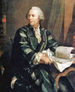

Leonhard Euler was the greatest mathematician of the 18th century and history in general.
Euler brilliantly graduated from the University of Basel and entered the St. Petersburg Academy of Sciences, then began to work at the Berlin Academy, and later to lead it. In 1766, the scientist received an invitation from the Russian Empress Catherine II and again came to St. Petersburg to continue his scientific work.
Here he published about 470 works in a wide variety of fields. One of them is a large-scale work "Mechanics" - an in-depth study of this science, including celestial mechanics. Euler by that time was practically blind, but continued to be actively engaged in science, in the records he was helped by his son Johann Albrecht and stenographers. Leonhard Euler made many fundamental discoveries that brought great benefit to mankind.
His massive contribution to the development of mathematics, mechanics, physics and astronomy cannot be overestimated, and his knowledge in the most diverse branches of science is admirable. During his lifetime, he published more than 850 works that contain in-depth studies of botany, chemistry, medicine, ancient languages, and music. Euler held membership in many academies of science around the world.
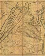

Joshua Fry was a British and American politician and planter, surveyor and cartographer.
Educated at Oxford University, Fry emigrated to the colony of Virginia around 1726. He soon founded a grammar school for the sons of the local gentry, then headed the mathematics department of the college, and worked as a professor of philosophy. Through a successful marriage, he became a large landowner and gained prominence, serving as a member of the House of Burgesses and justice of the peace in Essex County and later in Albemarle.
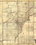
When Albemarle County was established in Virginia in 1745, Joshua Fry was appointed here as chief surveyor in charge of land surveying. Beginning in 1746, Fry was assisted throughout his work by his close friend Peter Jefferson, father of future U.S. President Thomas Jefferson. Together they not only explored new lands, but also created maps that documented the new territories with great accuracy. Their main project was the so-called Frye-Jefferson map, published in 1751, depicting Virginia and Maryland.
This map was unique for its time because it was based on actual geodetic data. The map showed the "Great Road from the Yadkin River through Virginia to Philadelphia 455 miles."
At the outbreak of the Seven Years' War, Joshua Fry was appointed head of the Virginia Regiment and died of his injuries in the campaign on May 31, 1754.
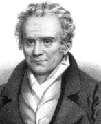

Johann Anton Güldenstädt was a Russian scientist, naturalist and traveler born of Baltic Germans.
Born in Riga, then part of the Russian Empire, Güldenstädt studied pharmacy, botany and natural history in Berlin from 1763. At the age of 22, he earned a doctorate in medicine from the University of Frankfurt. The following year he became a member of an expedition of the Russian Imperial Academy of Sciences sent by Catherine the Great to explore the southern borders of the Russian Empire.
Güldenstädt traveled through Ukraine and the Astrakhan region, as well as the North Caucasus and Georgia. In March 1775 the scientist returned to St. Petersburg. The results of this expedition were published after his premature death from typhoid fever at the age of 36.
This expedition made a great contribution in the fields of biology, geology, geography and especially linguistics. Guldenstedt made detailed notes on the languages of the region. Güldenstädt's materials are still constantly consulted by linguists. Dictionaries of one and a half dozen languages and dialects of the Caucasian peoples compiled by him 250 years ago serve as a valuable basis for research in linguistics and toponymy. He was one of the first European scholars to study the life and culture of the Kumyks, Ingush, Ossetians, Chechens and other North Caucasian peoples.
Güldenstädt was also the first to describe and characterize the soils, vegetation and fauna of the South Russian steppes, and one of the first to explain the origin of black soil.
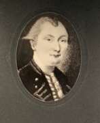

Samuel Johannes Holland was a Dutch-born British military engineer, surveyor and cartographer, and the first Inspector General of British North America.
He began his military career in 1745 in the Dutch artillery, moving to England in 1754 and becoming a lieutenant in the Royal American Army. In early 1756 Holland traveled with the British army to North America, where he created the first maps of New York State, worked as a military engineer, surveyed Louisbourg, Halifax, and Fort Fredericton, and participated in the siege of Quebec in 1759.
In 1764 Holland was appointed inspector general of the Northern District of North America and was appointed to the Quebec Council. From 1764 to 1767, he surveyed Prince Edward Island, the Madeleine Islands, and Cape Breton. He then mapped the northeast coast for the British army and helped negotiate provincial and state boundaries in the northeast. In 1779, Samuel Holland was appointed a member of the Legislative Council of Quebec and continued to serve as Inspector General for the rest of his life.
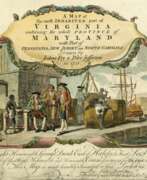

Peter Jefferson was an American cartographer and surveyor, father of the third President of the United States, Thomas Jefferson.
Peter Jefferson was the son of a large landowner in Virginia, and served as sheriff, surveyor, and justice of the peace. He was also a cartographer and surveyor. Along with Colonel and County Surveyor Joshua Fry, he spent several years exploring new lands. In 1750, Lewis Burwell, acting governor of Virginia, commissioned Frye and Jefferson to map the colony, which was done.
This map of early America was based on Frye and Jefferson's meticulous research and accurately delineated the boundaries, roads, settlements, and trails of the original inhabitants. It also included significant new geographic information reported by early wilderness travelers, including George Washington, Christopher Gist, and John Dalrymple. The map was completed in 1751 and engraved and published a few years later. Afterward, Jefferson worked on numerous surveying projects throughout Virginia.
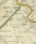

Thomas Jefferys was an 18th-century British cartographer and geographer, engraver and publisher.
As the best in the business of map-making, Jefferys held the honorary title of "King George III's geographer". He is known for his detailed and large-scale maps of the districts and counties of Great Britain as well as North America, particularly Virginia (1776). He was the leading map supplier of his day, engraving and printing maps for government and other official bodies.
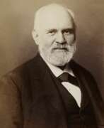

Heinrich Kiepert, full name Johann Samuel Heinrich Kiepert, was a German geographer and cartographer.
Kiepert is considered one of the most important map scholars of the second half of the 19th century. Educated at the University of Berlin, Kiepert worked with Karl Ritter (1779-1859). Together they produced one of the first modern atlases of the ancient Greek world, the Topographical-Historical Atlas of Hellas and the Hellenic Colonies in 24 sheets (1840-1846). He traveled to Asia Minor and produced two maps of the region in 1844.
Heinrich Kiepert also taught geography at the Humboldt University-Berlin for 40 years and was a member of the Prussian and Austrian Academies of Sciences.
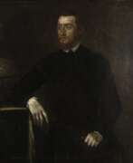

Gerardus Mercator, birth name Gheert Cremer was a Flemish geographer and cartographer, best known for the map projection that bears his name.
Gerardus Mercator was the first to use this equiangular cylindrical projection for drawing a navigational chart of the world on 18 sheets (1569). The Mercator projection is remarkable in that it does not distort angles and shapes and only keeps distances at the equator. It is currently used for nautical navigational and aeronautical charts. Although modern historical cartographic research has established that this projection was used as early as 1511, it is only by Mercator that it has become widely used.
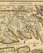

William Henry Mouzon, Jr. was an American cartographer and civil engineer.
Henry Mouzon, Jr. was the grandson of a Huguenot immigrant and was sent to France at the age of eight, where he was trained as a civil engineer and surveyor. In 1771 he and Ephraim Mitchell were sent to survey the boundaries of South Carolina. As a result, a map was created and published in 1775 that included both North and South Carolina with corrections to previous maps.
This map was entitled "An Accurate Map of North and South Carolina with their Indian Boundaries," and clearly showed all the mountains, rivers, swamps, marshes, bogs, bays, creeks, harbors, sandbanks and shoals on the coasts, and gave the names of the land owners. American, British, and French troops used this map during the American Revolution. A copy of this map, owned by George Washington, is now in the library of the American Geographical Society.
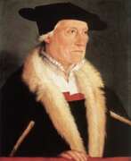

Sebastian Münster was a German Renaissance scholar, cartographer and cosmographer, historian and linguist-translator.
Münster studied at the University of Tübingen and later taught at the Universities of Basel and Heidelberg. He published several editions of Hebrew grammars and translations from that language, and was the first German to produce an edition of the Hebrew Bible.
In 1544 Münster published his Cosmographia, which was the earliest description of the history, geography, and organization of the world in German. This book was a great success, translated into many European languages and reprinted more than twenty times. "Cosmographia" contained many illustrations and geographical maps of the continents of the world, created by the best engravers of the time.
Among his other works were the "Trilingual Dictionary" (1530) in Latin, Greek, and Hebrew and the "Map of Europe" (1536).
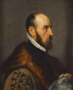

Abraham Ortelius (Ortels) was a Brabantian cartographer, geographer, and cosmographer. He is recognized as the creator of the first modern atlas, the Theatrum Orbis Terrarum (Theatre of the World). Along with Gemma Frisius and Gerardus Mercator, Ortelius is generally considered one of the founders of the Netherlandish school of cartography and geography. He was a notable figure of this school in its golden age (approximately 1570s–1670s) and an important geographer of Spain during the age of discovery. The publication of his atlas in 1570 is often considered as the official beginning of the Golden Age of Netherlandish cartography. He was the first person proposing that the continents were joined before drifting to their present positions. Beginning as a map-engraver, in 1547 he entered the Antwerp Guild of Saint Luke as an illuminator of maps. In 1560 when travelling with Mercator to Trier, Lorraine, and Poitiers, he seems to have been attracted, largely by Mercator's influence, towards the career of a scientific geographer. In 1564 he published his first map, Typus Orbis Terrarum, an eight-leaved wall map of the world. On 20 May 1570, Gilles Coppens de Diest at Antwerp issued Ortelius's Theatrum Orbis Terrarum, the "first modern atlas" (of 53 maps).
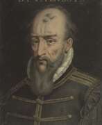

Bernard Palissy was a French natural scientist, painter, ceramicist and sculptor, geologist and writer of the French Renaissance.
Born into a family of artisans, Palissy apprenticed with his father as a glass artist and traveled throughout southwestern France comprehending pottery and studying geology. Today he is best known for his amazing lead-glazed pottery with images of various animals and people. After seeing a white glazed cup, probably of Chinese porcelain, in the 1540s, he set out to learn the secrets of its manufacture. His early research is described in De l'art de la terre. Although Palissy never succeeded in reproducing what he saw, his experiments gave him a thorough knowledge of the chemical compositions of minerals.
From 1575 in Paris, Palissy gave public lectures on natural history, which were published as Discours admirables (1580). In this treatise, Bernard Palissy touches on an incredibly wide range of subjects, from the techniques of ceramics, metallurgy and chemistry to hydrology, geology and fossils. He correctly identified fossils as the remains of ancient life. This work reveals him as a writer and scientist, a creator of modern agronomy and a pioneer of the experimental method, with scientific views generally more advanced than those of his contemporaries.
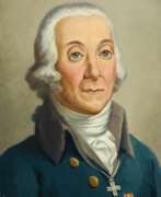

Peter Simon Pállas was a German and Russian scientist-encyclopedist, naturalist and traveler, who gave almost all his life to the service of Russia.
The breadth of his scientific interests made him a true encyclopedist, but he was particularly interested in natural sciences. By the age of 25, Pallas had already acquired European fame as a major scientist-naturalist. At the same time he received an invitation from the St. Petersburg Academy of Sciences, where he was offered a professorship. In 1767, Pallas arrived in St. Petersburg with his wife and soon led several important expeditions to Siberia and southern Russia. In his numerous ethnographic descriptions, the scientist was the first to report in detail on the Kalmyks, Tatars, Mordvins, Chuvashs, Nagaians, Tungus (Evenks), Votyaks (Udmurts), and Cheremis (Mari). In addition, he brought with him large natural-scientific collections. Later he traveled with scientific expeditions to Kamchatka, the Kuril Islands, Crimea and other previously unexplored lands.
In 1785 Catherine II attracted Pallas to the collection and comparative analysis of the languages of the peoples inhabiting America, Asia, Europe and Russia, and he compiled and published a comparative dictionary in two parts (1787-1789), in which more than 200 languages and dialects of the peoples of Asia and Europe were presented. In the last years of his life, among other things, Pallas was engaged in the preparation of a fundamental three-volume work on the fauna of Russia, Zoographia rosso-asiatica ("Russian-Asiatic Zoology"), in which more than 900 species of vertebrates, including 151 species of mammals, of which about 50 new species were introduced. This work was so extensive, and the descriptions of the animals were so thorough and detailed, that until the early 20th century the book remained the main source of knowledge about the fauna of Russia. In 1810. Peter Pallas went to Berlin to prepare illustrations for this work, but a year later the famous scientist died and was buried in Berlin.
A volcano in the Kuril Islands, a reef off New Guinea, and many animals and plants are named after Pallas.
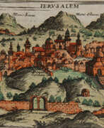

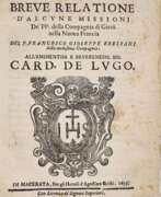
Giuseppe Rosaccio was an Italian physician, astronomer, cosmographer and cartographer.
Rosaccio graduated from the University of Padua, studied philosophy, medicine and law, and worked as a physician and judge. He became famous for a series of works that popularized a number of scientific disciplines. Some of his books deal with astrological medicine, specific diseases and their remedies, and the distillation of medicines from plants.
Giuseppe Rosaccio wrote about forty works on various topics of interest to him, but the main one was geography. He wrote an essay on the Muslim religion and treatises on geography, cosmography, astronomy, and astrology, which became very popular and were repeatedly reprinted.
Rosaccio created many atlases and small-format geographical works. Among his works is Ptolemy's Geography, which contains many indexes and is written in Italian (1599). He also authored a large map of the world (1597), and a large map of Italy and Tuscany (1609). His book Journey from Venice to Constantinople includes maps of the route with brief texts, that is, it is essentially an illustrated version of a pilgrimage to the Holy Land.
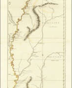

John Ross was an American military cartographer and surveyor.
Lieutenant John Ross served as a surveyor in the 34th Regiment of the British Army. After the Treaty of Paris in 1763, a British expedition was sent into Illinois Territory to demand the surrender of Fort de Chartres, the last outpost under French control in the area. John Ross traveled with this expedition, surveyed the lower river to the mouth of the Mississippi River, and created a unique map. It was titled "The Course of the Mississippi River from Balise to Fort Chartres; taken on an Expedition to Illinois" and published in London in 1775.
Lieutenant Ross's large-scale map of the Mississippi River is one of the few large format maps of the Mississippi published in the 18th century. Ross's map was the first official English survey of the Lower Mississippi and one of the most historically significant American maps. It delineated British territorial acquisitions after the French and Indian War and then established the future western boundary of the new United States. The map opened the territory to settlement from the east and defined the western boundaries of the American colonies.
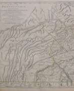

William Scull was an American cartographer and officer during the War of Independence.
William Scull was an officer during the Revolutionary War and then lived in Philadelphia and worked as a cartographer. He was the grandson of the famous Nicholas Scull, who served as Surveyor General of Pennsylvania during the colonial era. William Scull, fulfilling a commission from Penn Brothers landowners, created the famous map of Pennsylvania with southern boundaries showing Philadelphia, Bucks, Northampton, Berks, Chester, Lancaster, Cumberland, and York counties. William based his work on a map created by his grandfather and supplemented and expanded it with his own 1769 surveys.
As a result, Scull's 1770 map is among the largest and finest maps produced in America in the eighteenth century. It was published and reprinted many times in England and France; it was often included in composite atlases containing related maps. William Scull served in the Geographical Department of the Continental Army and was also a member of the American Philosophical Society.
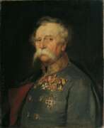

Franz Edler von Hauslab or Franz Ritter von Hauslab was an Austrian military commander, military educator, cartographer, geologist and artist.
He graduated from the engineering academy and then taught at it, achieving great success in topography and cartography. During the Austro-Italian-French War in 1859 he commanded artillery.
Von Hauslab was engaged in geological research and published several scientific works. He introduced a number of innovations in Austrian cartography, such as creating a color scale for contour lines on maps and introducing color lithography to cartography. Von Hauslab was a member of many learned societies.
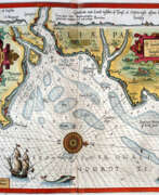

Lucas Waghenaer, full name Lucas Janszoon Waghenaer, was a famous Dutch cartographer, navigator, navigator and writer of the Golden Age.
Between 1550 and 1579, Waghenaer sailed the seas as a senior assistant captain and probably socialized with Portuguese, Spanish, and Italian navigators. The knowledge of nautical charts and the instructions Waghenaer received as a result of these contacts had a great influence on his later work as a cartographer. It is evident that the charts he made had to be based on his observations, and in all his work he had to draw on his own extensive experience of practical navigation. His book Spieghel der Zeevaerdt ("The Navigator's Mirror") or Speculum nauticum super navigatione, first published in 1584, occupies a unique place among the nautical printed works of the sixteenth century, for it is the first printed work with maps.
Moreover, in terms of the magnificent design of the maps and text, it surpasses all other editions of this period and served as a model for pilotage guides and folios with maps even a century later. It is an atlas of nautical charts with instructions for navigation in the western and northwestern coastal waters of Europe. Thanks to the unrivaled skill of engravers Baptiste and Johannes van Deitekom, Waghenaer's original maps were transformed into the most beautiful maps of the time. This book was a huge success, reprinted several times and translated into English, German, Latin and French.
In 1592, Waghenaer's second pilot book Thresoor der zeevaert ("Treasure of Navigation") was published, and in 1598, the third and last publication Enchuyser zeecaertboeck ("Enkhuizen Book of Nautical Charts").
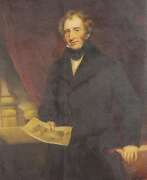

Isaac Weld was an Irish explorer, writer, and artist.
After completing his studies, Isaac Weld traveled to the new lands of America in 1795, meeting Thomas Jefferson and George Washington. The purpose of his journey was to learn of opportunities for Irish resettlement. Returning in 1797, Weld soon published his book, A Journey through the States of North America and the Provinces of Upper and Lower Canada. In general, Weld did not like the United States; he particularly noted the practice of slavery and the treatment of Native peoples by the rude new Americans. But he liked Canada and Quebec: he praised the views from the Citadel and reported that because of the low cost of land, a middle-income person could easily settle in the country for himself and his family.
This book by Weld was quite popular: it went through several editions from its first publication in 1799 to 1807. By 1820, it had also been translated into French, German, Italian, and Dutch.
In 1800 Weld was elected a member of the Royal Society of Dublin. In 1811 and 1812 he served on the library committee, and on December 4, 1828, he was elected honorary secretary. His first act in this capacity was to establish an annual exhibition of specimens of the manufactures and products of Ireland. Isaac Weld published several other books on Ireland and Great Britain, illustrated with his own drawings. Of these, his Statistical Survey of the County of Roscommon, over seven hundred pages long, published by the Royal Dublin Society in 1832, stands out.
