Cartographers
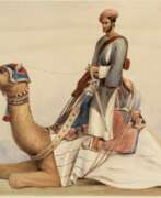

Robert Baikie was a Scottish-born physician, writer and artist.
Baikie spent more than 17 years as a doctor in India with the East India Company's Madras Army, as Chief Medical Officer of the Nilgiris, and has written extensively about the region. It is a fascinating account of the Nilgiri Mountains with maps of the hills and approaches to them, sketches of the scenery, drawings of the principal buildings and tables of routes. This work by Robert Baikie was later published as Observations on the Nilgiri, including an account of their topography, climate, soil and produce.
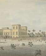

William Baillie was a British artist who lived and worked in India in the late 18th century.
He went to India in 1777 as a cadet in the Bengal Infantry and remained there for the rest of his life. After retiring, he published a newspaper in Calcutta, painted landscapes with views of the city and surrounding countryside, made engravings, and made topographical maps. In 1794, William Baillie published a set of hand-colored aquatints entitled Twelve Views of Calcutta.
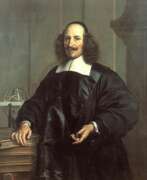

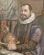
Jan (Joan) Willemsz. Blaeu was a Dutch cartographer, publisher and judge.
Jan was born into the family of the cartographer and publisher Willem Janszoon Blaeu (1571-1638). He studied in Leiden, where he earned a doctorate in law, and in Padua. He then began to assist his father, who was engaged in the manufacture of globes and maps. After his father's death, Jan, together with his brother Cornelius, continued his work, and succeeded him as cartographer for the Dutch East India Company.
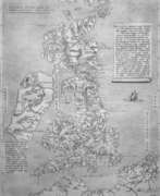
In 1651 Blaeu was elected to the Amsterdam city council and later appointed as a judge. At the same time, he was engaged in his publishing business: he continued to publish volumes of Atlas novus, which contained maps of English counties and, for the first time, an atlas of Scotland, as well as one volume of maps of the Far East.
Blaeu did not have time to complete his most ambitious project, but it made him famous as the author of the famous 11-volume Dutch atlas. Based on his previous maps, Blaeu created the Great Atlas (Atlas Maior) - it contained nearly 600 maps and a total of 3,000 pages of Latin text - and was published in 1662. Blaeu's maps were groundbreaking for their time because they were created in accordance with the heliocentric theories of Nicolaus Copernicus.
In 1672, a great fire in Amsterdam destroyed Blaeu's workshop, and the cartographer died a year later, apparently never recovering from this stroke of fate.
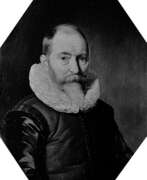

Willem Janszoon Blaeu was a Dutch cartographer and map publisher.
Willem studied astronomy and cartography under the Danish astronomer Tycho Brahe and even discovered the variable star P Swan in 1600. A little later Blaeu settled in Amsterdam, where he began making globes and also began producing land and sea maps, including a 1605 world map. In 1629 he managed to acquire the printing plates of the cartographer Jodok Hondius, with which he published his own atlas.
In 1633, Willem Blaeu was appointed cartographer of the Dutch Republic, as well as the official cartographer of the Dutch East India Company. Blau built up a large collection of maps and conducted an extensive publishing business. After Willem's death, his sons Jan Blaeu (1596-1673) and Cornelius Blaeu successfully continued his work. But in 1672, during a fire in Amsterdam, Blaeu's workshop was destroyed, and the company founded by Willem Blaeu ceased to exist in 1698.
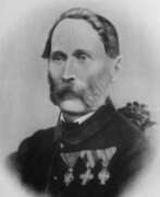

Joseph Georg Böhm was an Austrian astronomer, astrophysicist, cartographer, mathematician, and educator.
At the University of Prague, Böhm attended lectures in mathematics, physics, astronomy, and, after receiving his doctorate, became an assistant at the Vienna Observatory under Joseph Johann von Littrow. He then worked at the observatory at Othen and taught mathematics at the University of Salzburg. In 1839 he was appointed professor of mathematics and practical geometry at the University of Innsbruck, and in 1848 he was elected its rector. In 1852 Böhm was appointed director of the Prague Observatory and professor of theoretical and practical astronomy at the University of Prague.
Georg Böhm published several significant astronomical papers on solar observation. He is the creator of several instruments for astronomical measurements and observations, and he designed the Uranoscope and Universal Gnomon for amateur astronomical observations for the general public. As a member of the commission for the repair of the Prague Astronomical Clock, which he joined in 1865, he wrote a detailed description of it in the work Beschreibung der alterthümlichen Prager Rathausuhr. In addition to astronomy and its popularization, he was also involved in agriculture, economics, and geodesy. One of his important works is Ballistic Experiments (1865).
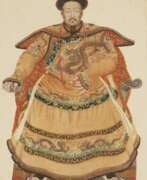

Joachim Bouvet was a French Jesuit monk and missionary who worked in China.
Joachim Bouvet was one of six Jesuit mathematicians chosen by Louis XIV to travel to China as his envoys and work as missionaries and scholars. In 1687 in Beijing, Bouvet began this work, especially in mathematics and astronomy, and in 1697 the Chinese emperor Kangxi (1654-1722) sent him as ambassador to the French king. Kangxi expressed his wish that Bouvet should bring more missionary scientists with him. Thus, in addition to his scholarly work, Bouvet was also an accomplished diplomat and served as a liaison between the Chinese Emperor Kangxi and King Louis XIV of France.
Bouvet brought to France a manuscript describing Kangxi's life with an eye for diplomatic subtleties, as well as a collection of drawings depicting graceful Chinese figures in traditional and ceremonial dress. The first French edition of The Historical Portrait of the Emperor of China was published in Paris in 1697, and was subsequently translated and published in other languages. And Bouvet returned to China in 1699 with ten new missionaries and a collection of King Louis XIV's engravings for Emperor Kangxi. He remained in China for the rest of his life.
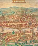

Georg Braun was a German topographical geographer, cartographer and publisher.
Braun was the editor-in-chief of the Civitates orbis terrarum, a groundbreaking atlas of cities, one of the major cartographic achievements of the 16th century. It was the first comprehensive and detailed atlas, with plans of the world's famous cities and bird's-eye views, and became one of the best-selling works of the time.
The book was prepared by Georg Braun in collaboration with the Flemish engraver and cartographer Frans Hoogenberg. Braun, as editor-in-chief, acquired tables, hired artists, and wrote the texts. They drew on existing maps as well as maps based on drawings by the Antwerp artist Joris Hofnagel and his son Jacob. Other authors include Pieter Bruegel the Elder (c. 1525-1569), Jacob van Deventer (c. 1505-1575), and more than a hundred other artists and engravers.
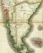

Juan de la Cruz Cano y Olmedilla was a Spanish artist, engraver, and cartographer of the Enlightenment.
Using the most accurate cartographic calculations and methods in the 18th century, he created many geographic maps of Africa and South America, the Strait of Magellan, and others. While in the service of King Carlos III of Spain for many years, Olmedilla mapped Spain and Spanish possessions in Latin America.
Olmedilla also created a multi-volume work devoted to Spanish costume. This collection recorded the various outfits worn by Spaniards, both common and noble, covering all regions of the country and all of its colonies. The topographical and architectural details included in the plates provide additional insight into the mores and geographical features of the various cities and towns depicted. The work was first published in Madrid between 1777 and 1788. These engravings proved incredibly popular and were reprinted in both France and Germany.
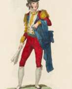

Juan Carrafa was a Spanish cartographer and engraver who worked in Madrid in the 19th century.
He was educated at the Academy of Fine Arts of San Fernando. Among others, Juan Carrafa is known for a large work of more than one hundred engravings depicting the Spanish costume of various regions of Spain, which he produced from drawings by the artist José Ribelles (1778-1835). The prints depict a variety of professions, including bullfighters, gypsies, sailors, merchants, fishermen, students, porters, etc. The selection was published in Real Calcografía from 1825.
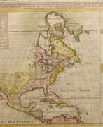


Justus Danckerts I was a Dutch engraver and print publisher who along with other members of the Danckerts family created one of the leading Dutch geographical map and atlas publishing houses. Justus Danckerts was the son of Cornelis Danckerts I (1603-1656), who established the Danckerts cartographic family business in Amsterdam. After producing in the early 1680s over 20 folio-sized atlas maps, he published in 1686-1887 the first Danckerts atlas. In 1690, another 26-sheet geographical atlas was published; between 1698 and 1700, a 60-sheet atlas was completed. Its map sheets and plates were used by various publishers until the middle of the 18th century.
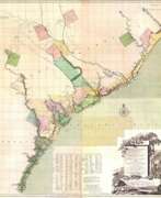

Johann Wilhelm Gerhard von Brahm, also known as John William Gerard de Brahm, was a German cartographer, military engineer, and surveyor who worked for Great Britain to develop the lands of the New World.
His father was court musician to the Elector of Trier and gave his son an excellent early education. After a successful career as a military engineer in the Bavarian army, de Brahm traveled to Georgia in 1751 at the head of a group of German emigrants. There he displayed his talents as a surveyor and engineer, worked as a cartographer, and was commissioned by South Carolina Governor James Glen to design and build a system of fortifications for Charleston.
In 1755 de Brahm was appointed inspector general of lands for South Carolina and soon for the entire New World. He settled in St. Augustine, where he spent the next six years researching and preparing maps. His major works, "Map of South Carolina" and "Map of South Carolina and Part of Georgia," provide detailed topography and even describe underwater features. And his "Report of a General Survey of the Southern District of North America" records every detail from tide times to tips on tilling the soil. De Brahm's book The Atlantic Pilot, an instruction manual for sailing in Florida, was published in London and included the first published map of the Gulf Stream.
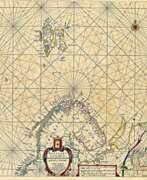

Hendrick Doncker was a Dutch cartographer and publisher of nautical charts, atlases, and books.
An innovator among the first generation of Dutch cartographers, Doncker worked to produce modern nautical charts, which were valued by sailors and a wide audience for their accuracy and precision. Doncker promptly followed geographical discoveries and achieved success by constantly improving and updating old maps, which was a rarity at the time. His major work is the Zee-Atlas (nautical atlas), which was reprinted for 50 years.
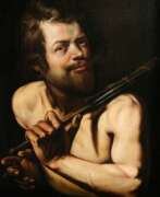

Martin Hermann Faber was a German painter, architect, and cartographer. He was also a copper engraver in Rome. He lived and worked most of his life in Emden, where he still remains one of the most respected and significant artistic personalities of the city.
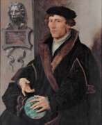

Gemma Frisius, born Jemme Reinerszoon Frisius, was a Dutch mathematician, physician, cartographer, philosopher, engraver, and master of astronomical instruments.
He taught mathematics and medicine at the University of Leuven and applied his mathematical knowledge to astronomy, geography, and map-making. Frisius participated in the creation of the latest globes and used mathematics in geodesy and navigation in new ways and invented or improved many instruments, including the cross staff, the astrolabe, and the astronomical rings (also known as "Gemma rings"). He ran a workshop for making such instruments.
Frisius is credited with being one of the founders of the Dutch school of cartography.
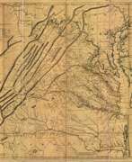

Joshua Fry was a British and American politician and planter, surveyor and cartographer.
Educated at Oxford University, Fry emigrated to the colony of Virginia around 1726. He soon founded a grammar school for the sons of the local gentry, then headed the mathematics department of the college, and worked as a professor of philosophy. Through a successful marriage, he became a large landowner and gained prominence, serving as a member of the House of Burgesses and justice of the peace in Essex County and later in Albemarle.
When Albemarle County was established in Virginia in 1745, Joshua Fry was appointed here as chief surveyor in charge of land surveying. Beginning in 1746, Fry was assisted throughout his work by his close friend Peter Jefferson, father of future U.S. President Thomas Jefferson. Together they not only explored new lands, but also created maps that documented the new territories with great accuracy. Their main project was the so-called Frye-Jefferson map, published in 1751, depicting Virginia and Maryland.
This map was unique for its time because it was based on actual geodetic data. The map showed the "Great Road from the Yadkin River through Virginia to Philadelphia 455 miles."
At the outbreak of the Seven Years' War, Joshua Fry was appointed head of the Virginia Regiment and died of his injuries in the campaign on May 31, 1754.
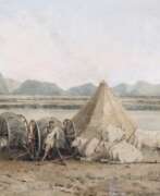

John Gantz was an Austrian-born architect, painter, surveyor and lithographer.
Gantz worked for the East India Company from about 1800 to 1803 as a draftsman and architect. A manuscript list of Madras residents dated March 1819 lists him as "Architect, originally from India". By 1827, Gantz had installed the first lithographic printing press in Madras, one of the first such printing presses in India. Gantz's drawings depict the bridges and architectural structures of the city, the inhabitants in their daily activities, modes of transportation, crafts and professions of Indians, he also painted picturesque landscapes of India.
Gantz had two sons, architect Justinian and Julius.
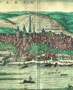

Frans Hogenberg was a Flemish and German painter, engraver, and mapmaker. He is known for portraits and topographical views as well as historical allegories. He also produced scenes of contemporary historical events. Hogenberg was the author of graphic works, engravings of city views and maps of the first four volumes of the six-volume atlas Theatrum Orbis Terrarum (Description and drawings of the most famous cities in the world), published in 1570 by the Flemish geographer Abraham Ortelius. Hogenberg's engravings are an invaluable source of information about urban development in medieval Europe.
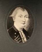

Samuel Johannes Holland was a Dutch-born British military engineer, surveyor and cartographer, and the first Inspector General of British North America.
He began his military career in 1745 in the Dutch artillery, moving to England in 1754 and becoming a lieutenant in the Royal American Army. In early 1756 Holland traveled with the British army to North America, where he created the first maps of New York State, worked as a military engineer, surveyed Louisbourg, Halifax, and Fort Fredericton, and participated in the siege of Quebec in 1759.
In 1764 Holland was appointed inspector general of the Northern District of North America and was appointed to the Quebec Council. From 1764 to 1767, he surveyed Prince Edward Island, the Madeleine Islands, and Cape Breton. He then mapped the northeast coast for the British army and helped negotiate provincial and state boundaries in the northeast. In 1779, Samuel Holland was appointed a member of the Legislative Council of Quebec and continued to serve as Inspector General for the rest of his life.
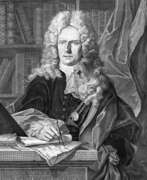

Johann Baptist Homann was a German geographer and cartographer, who also made maps of the Americas. In 1702 he founded his own publishing house. Homann acquired renown as a leading German cartographer, and in 1715 was appointed Imperial Geographer by Emperor Charles VI. In the same year he was also named a member of the Prussian Academy of Sciences in Berlin. In 1716 Homann published his masterpiece Grosser Atlas ueber die ganze Welt (Grand Atlas of all the World). Numerous maps were drawn up in cooperation with the engraver Christoph Weigel the Elder, who also published Siebmachers Wappenbuch.
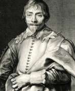

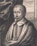

Hendrik Hondius I was a Flemish-born and trained engraver, cartographer, and publisher who settled in the Dutch Republic in 1597. Hondius was apprenticed in Brussels to Godfried van Ghelder, goldsmith to Alexander Farnese, Duke of Parma. He also studied drawing with the engraver Jan Wierix of Antwerp. At this time he started to study engraving. He applied himself to mathematics and studied perspective, architecture and the construction of fortifications. He moved to The Hague by 1597. He obtained his first print privilege for a portrait of Prince Maurits. He dedicated himself to his engraving practice. His work was very well received and he got commissions from many eminent personalities for engravings or drawings. He turned more to publishing rather than engraving and printing in the 1630s. His publications were mainly maps, books about fortifications and official portraits.[5] He also reused original plates and blocks by earlier artists for reprinting and such reprints represented almost a third of his publishing output. In the 1640s he returned to printing concentrating exclusively on etching. One of the most important publications of Hondius was the work Pictorum aliquot celebrium praecipue Germaniae inferioris Effigies (Effigies of some celebrated painters, chiefly of Lower Germany) of 1610, which was a collection of 69 portraits of mainly Netherlandish artists.
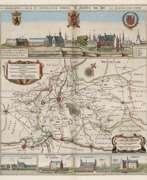

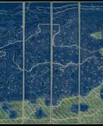

Qianren Huang was a Chinese cartographer and clerk who worked in the 18th century during the reign of the Qianlong Emperor.
His grandfather, Huang Zongxi (1610-1695), was a famous Qing Chinese polymath, Confucian scholar, cartographer, and father of the Chinese Enlightenment.
Qianren Huang is known for his 1767 revision of the map created by his grandfather Huang Zongxi, the so-called famous "Blue Map" of the world. Continuing the family tradition of outstanding scientific achievements, his grandson pointed out the addition of new territories such as Tibet and Xinjiang on the updated map, emphasizing the continuous strengthening of the Chinese state.
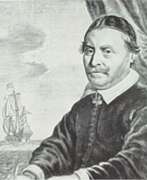

Johannes Janssonius was a Dutch cartographer, printer and publisher.
In 1616 Janssonius created his first maps of France and Italy, and every year he expanded and improved their publishing. The so-called "Great Atlas" already numbered eleven volumes. The editions were printed in Dutch, Latin, French and German.
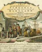

Peter Jefferson was an American cartographer and surveyor, father of the third President of the United States, Thomas Jefferson.
Peter Jefferson was the son of a large landowner in Virginia, and served as sheriff, surveyor, and justice of the peace. He was also a cartographer and surveyor. Along with Colonel and County Surveyor Joshua Fry, he spent several years exploring new lands. In 1750, Lewis Burwell, acting governor of Virginia, commissioned Frye and Jefferson to map the colony, which was done.
This map of early America was based on Frye and Jefferson's meticulous research and accurately delineated the boundaries, roads, settlements, and trails of the original inhabitants. It also included significant new geographic information reported by early wilderness travelers, including George Washington, Christopher Gist, and John Dalrymple. The map was completed in 1751 and engraved and published a few years later. Afterward, Jefferson worked on numerous surveying projects throughout Virginia.
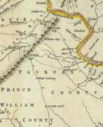

Thomas Jefferys was an 18th-century British cartographer and geographer, engraver and publisher.
As the best in the business of map-making, Jefferys held the honorary title of "King George III's geographer". He is known for his detailed and large-scale maps of the districts and counties of Great Britain as well as North America, particularly Virginia (1776). He was the leading map supplier of his day, engraving and printing maps for government and other official bodies.
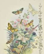

Paul Jerrard was a British artist, illustrator, cartographer and publisher.
His publishing house, Jerrard & Son, Paul & Son, produced Shakespearean paintings, ornithological, entomological and botanical publications, species, sheet music, gift books, almanacs etc.
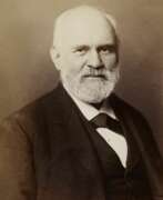

Heinrich Kiepert, full name Johann Samuel Heinrich Kiepert, was a German geographer and cartographer.
Kiepert is considered one of the most important map scholars of the second half of the 19th century. Educated at the University of Berlin, Kiepert worked with Karl Ritter (1779-1859). Together they produced one of the first modern atlases of the ancient Greek world, the Topographical-Historical Atlas of Hellas and the Hellenic Colonies in 24 sheets (1840-1846). He traveled to Asia Minor and produced two maps of the region in 1844.
Heinrich Kiepert also taught geography at the Humboldt University-Berlin for 40 years and was a member of the Prussian and Austrian Academies of Sciences.
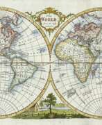

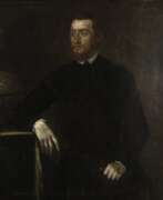

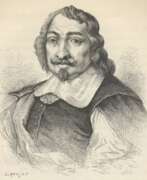
Gerardus Mercator, birth name Gheert Cremer was a Flemish geographer and cartographer, best known for the map projection that bears his name.
Gerardus Mercator was the first to use this equiangular cylindrical projection for drawing a navigational chart of the world on 18 sheets (1569). The Mercator projection is remarkable in that it does not distort angles and shapes and only keeps distances at the equator. It is currently used for nautical navigational and aeronautical charts. Although modern historical cartographic research has established that this projection was used as early as 1511, it is only by Mercator that it has become widely used.
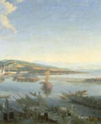

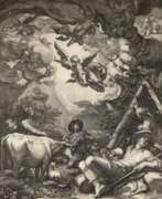
Conrad Meyer, a Swiss painter, engraver, and medallist, made significant contributions to the art world of his time. Initially a painter of portraits and landscapes, Meyer eventually shifted his focus to copper engraving, producing over a thousand works in his lifetime. Notable among his creations is the map of Switzerland by Conrad Gyger, which he produced in 1657, and his Planisphaerium Coeleste from 1681.
Conrad Meyer's artworks, such as "The Wild Man" (1649), "The Devil's Kitchen Visited by an Angel," and "Allegory of the Transience of Life" (1651), showcase his meticulous technique and are held in high regard, with several pieces housed in the Metropolitan Museum of Art. His work "Parable of the Ungrateful Servant" is part of the Philadelphia Museum of Art's collection, demonstrating his prowess in etching as well.
For art collectors and experts, Conrad Meyer's contributions to Swiss art and engraving offer valuable insights into the 17th-century European art scene, particularly in the context of Zurich. His legacy is encapsulated in the diverse range of subjects he explored, from detailed landscapes to intricate portraits and allegorical scenes, reflecting the cultural and artistic vibrancy of his era.
If you are an enthusiast or collector keen on Conrad Meyer's art, consider signing up for updates related to new sales and auction events concerning his works. This will ensure you stay informed about opportunities to acquire pieces connected to this notable Swiss artist.
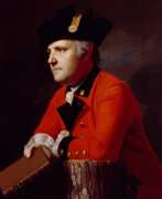

John Montresor was a British military engineer and cartographer who worked in North America.
His father was a military engineer and his youth was spent in British Gibraltar. Montresor studied in London, and in 1754 accompanied his father to North America when he was appointed chief engineer to Major General Edward Braddock's troops. John participated in various expeditions, delivered dispatches, and witnessed the sieges of Louisbourg and Quebec. During his service, he also did the necessary research and prepared maps of Acadia, the St. Lawrence River, and his route along the Kennebec River.
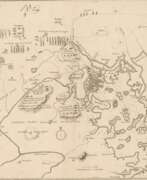
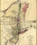
One of John Montresor's major accomplishments is the strategic map of the Hudson River, one of the most detailed maps of the New York City area during the American Revolution, first published in 1775. The map extends from Lake Champlain down the Hudson to Long Island, with insets of Lake Champlain and the White Hills in the upper Connecticut Valley.
John Montresor was promoted to captain in 1776, returned to England in 1779, and retired from the army. He died in prison 20 years later, accused of excessive spending while in the service.
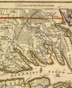

William Henry Mouzon, Jr. was an American cartographer and civil engineer.
Henry Mouzon, Jr. was the grandson of a Huguenot immigrant and was sent to France at the age of eight, where he was trained as a civil engineer and surveyor. In 1771 he and Ephraim Mitchell were sent to survey the boundaries of South Carolina. As a result, a map was created and published in 1775 that included both North and South Carolina with corrections to previous maps.
This map was entitled "An Accurate Map of North and South Carolina with their Indian Boundaries," and clearly showed all the mountains, rivers, swamps, marshes, bogs, bays, creeks, harbors, sandbanks and shoals on the coasts, and gave the names of the land owners. American, British, and French troops used this map during the American Revolution. A copy of this map, owned by George Washington, is now in the library of the American Geographical Society.
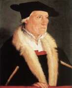

Sebastian Münster was a German Renaissance scholar, cartographer and cosmographer, historian and linguist-translator.
Münster studied at the University of Tübingen and later taught at the Universities of Basel and Heidelberg. He published several editions of Hebrew grammars and translations from that language, and was the first German to produce an edition of the Hebrew Bible.
In 1544 Münster published his Cosmographia, which was the earliest description of the history, geography, and organization of the world in German. This book was a great success, translated into many European languages and reprinted more than twenty times. "Cosmographia" contained many illustrations and geographical maps of the continents of the world, created by the best engravers of the time.
Among his other works were the "Trilingual Dictionary" (1530) in Latin, Greek, and Hebrew and the "Map of Europe" (1536).
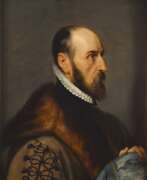

Abraham Ortelius (Ortels) was a Brabantian cartographer, geographer, and cosmographer. He is recognized as the creator of the first modern atlas, the Theatrum Orbis Terrarum (Theatre of the World). Along with Gemma Frisius and Gerardus Mercator, Ortelius is generally considered one of the founders of the Netherlandish school of cartography and geography. He was a notable figure of this school in its golden age (approximately 1570s–1670s) and an important geographer of Spain during the age of discovery. The publication of his atlas in 1570 is often considered as the official beginning of the Golden Age of Netherlandish cartography. He was the first person proposing that the continents were joined before drifting to their present positions. Beginning as a map-engraver, in 1547 he entered the Antwerp Guild of Saint Luke as an illuminator of maps. In 1560 when travelling with Mercator to Trier, Lorraine, and Poitiers, he seems to have been attracted, largely by Mercator's influence, towards the career of a scientific geographer. In 1564 he published his first map, Typus Orbis Terrarum, an eight-leaved wall map of the world. On 20 May 1570, Gilles Coppens de Diest at Antwerp issued Ortelius's Theatrum Orbis Terrarum, the "first modern atlas" (of 53 maps).
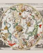

Reinier & Joshua Ottens was a Dutch printing publishing partnership of two brothers.
The publishing house was founded in 1726 in Amsterdam by brothers Reinier Ottens (1698-1750) and Joshua Ottens (1704-1765). After the death of Reinier I, his son Reinier II continued the business until 1765. Much of the activity of this business consisted of reissuing old plates.
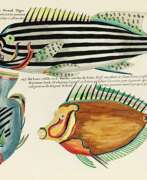

Louis Renard was a Dutch painter, printmaker and book publisher born in France.
Renard published map atlases and illustrated works of natural history popular in 18th-century Europe. In Amsterdam he acquired many cartographic plates by Frederick de Wit, which he combined with minor updates and corrections into an Atlas of Navigation and Commerce and published in 1715. He later sold the plates to R. & J. Ottens, who republished it in 1745.
In 1718 -1719 Renard published the first edition of his most famous multi-volume work, Poissons, écrevisses et crabes... que l'on trouve autour des Isles Moluques, et sur les cotes des Terres Australes ("Fish, crayfish and crabs, of varied colors and unusual forms, which are found around the Moluccas Islands and on the coasts of the southern lands."). This book was the world's first encyclopedia of fish illustrated in color. While working on it, Renard copied drawings by other artists, notably the talented Dutch artist Samuel Fallors. The result was 460 hand-colored copperplate prints.
The creatures in Renard's book are so fanciful that they may seem fictional, but only about 10 percent are, including the depiction of a mermaid. Most likely, these fantasies were included for the sake of attracting buyers. The work is now believed to be an important part of eighteenth-century scientific literature.
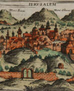

Giuseppe Rosaccio was an Italian physician, astronomer, cosmographer and cartographer.
Rosaccio graduated from the University of Padua, studied philosophy, medicine and law, and worked as a physician and judge. He became famous for a series of works that popularized a number of scientific disciplines. Some of his books deal with astrological medicine, specific diseases and their remedies, and the distillation of medicines from plants.
Giuseppe Rosaccio wrote about forty works on various topics of interest to him, but the main one was geography. He wrote an essay on the Muslim religion and treatises on geography, cosmography, astronomy, and astrology, which became very popular and were repeatedly reprinted.
Rosaccio created many atlases and small-format geographical works. Among his works is Ptolemy's Geography, which contains many indexes and is written in Italian (1599). He also authored a large map of the world (1597), and a large map of Italy and Tuscany (1609). His book Journey from Venice to Constantinople includes maps of the route with brief texts, that is, it is essentially an illustrated version of a pilgrimage to the Holy Land.
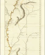

John Ross was an American military cartographer and surveyor.
Lieutenant John Ross served as a surveyor in the 34th Regiment of the British Army. After the Treaty of Paris in 1763, a British expedition was sent into Illinois Territory to demand the surrender of Fort de Chartres, the last outpost under French control in the area. John Ross traveled with this expedition, surveyed the lower river to the mouth of the Mississippi River, and created a unique map. It was titled "The Course of the Mississippi River from Balise to Fort Chartres; taken on an Expedition to Illinois" and published in London in 1775.
Lieutenant Ross's large-scale map of the Mississippi River is one of the few large format maps of the Mississippi published in the 18th century. Ross's map was the first official English survey of the Lower Mississippi and one of the most historically significant American maps. It delineated British territorial acquisitions after the French and Indian War and then established the future western boundary of the new United States. The map opened the territory to settlement from the east and defined the western boundaries of the American colonies.
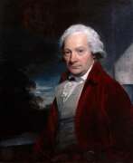

Paul Sandby was a British watercolorist, draughtsman and printmaker, and a founder member of the Royal Academy.
Sandby first worked as a draughtsman and cartographer before painting his first paintings, watercolors of bridges, fortifications and Scottish landscapes, as well as views of Windsor. These works eventually made him a sought-after artist. Sandby also painted many caricatures and skillfully documented eighteenth-century British social life.
In 1768, Sandby, his brother Thomas Sandby and 27 other artists became founding members of the Royal Academy in London. He is now considered one of the founders of English watercolor.
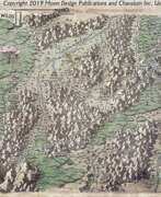

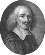

Nicolas Sanson the Elder (Nicolas Sanson d’Abbeville) was a French cartographer who served under two kings in matters of geography. He has been called the "father of French cartography." He gave lessons in geography both to Louis XIII and to Louis XIV. Active from 1627, Sanson issued his first map of importance, the "Postes de France". After publishing several general atlases himself he became the associate of Pierre Mariette, a publisher of prints. He died in Paris on 7 July 1667. Two younger sons succeeded him as geographers to the king. Sanson's maps were used as a model by his son, Guillaume, and, at least initially, by Duval, his nephew, in his 1664 folio map and 1660 atlas minor map. In 1692 Hubert Jaillot collected Sanson's maps in an Atlas nouveau.
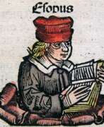

Hartmann Schedel was a German humanist, medical scientist, historian and chronicler.
Schedel was the first to compile a world chronicle, the so-called Visual History of the Earth from the Creation of the World to the 1490s, known as Schedelsche Weltchronik (Schedel's World Chronicle). It was published in 1493 in Nuremberg. About 600 woodcuts for this book were created by the artists and engravers Michael Wolgemuth (1434-1519) and Albrecht Dürer (1471-1528). The illustrations depict biblical scenes, family trees, portraits of famous personalities, and fairy tale or legendary creatures. However, the main ones here were maps of the world, Germany and Central Europe.
Hartmann Schedel was one of the first cartographers to use machine printing. He was also a renowned collector of books, artworks and engravings by old masters.
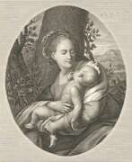

Johann Carl Schleich the Elder was a German engraver. On the basis of paintings he created engraving portraits of famous contemporaries, made topographical works. His son, Johann Carl Schleich the Younger, was also an engraver.
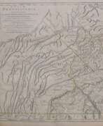

William Scull was an American cartographer and officer during the War of Independence.
William Scull was an officer during the Revolutionary War and then lived in Philadelphia and worked as a cartographer. He was the grandson of the famous Nicholas Scull, who served as Surveyor General of Pennsylvania during the colonial era. William Scull, fulfilling a commission from Penn Brothers landowners, created the famous map of Pennsylvania with southern boundaries showing Philadelphia, Bucks, Northampton, Berks, Chester, Lancaster, Cumberland, and York counties. William based his work on a map created by his grandfather and supplemented and expanded it with his own 1769 surveys.
As a result, Scull's 1770 map is among the largest and finest maps produced in America in the eighteenth century. It was published and reprinted many times in England and France; it was often included in composite atlases containing related maps. William Scull served in the Geographical Department of the Continental Army and was also a member of the American Philosophical Society.
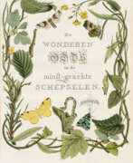

Jan Christiaan Sepp was a Dutch book publisher, printmaker and illustrator.
Jan Christiaan Sepp belonged to a dynasty of collectors, publishers and traders in printed books founded by his father, Christian Sepp (c. 1700-1775) in Goslar, Germany. Jan Christian Sepp is known for being the chief illustrator, creating the magnificent engravings for Cornelius Nozeman's highly prized work entitled Nederlandsche Vogelen (Birds of the Netherlands, 1770-1829). These copperplate engravings, superbly composed, meticulously engraved and hand-colored are of great value.
After Christian Sepp's death, the work of illustrating the five volumes was completed by his son, Jan Sepp. Each volume of this five-volume work of science and art contains 50 images of bird species, and each species is described on several pages.
