John Mount (1725-1786), Thomas Page III (1730-1781) and William Mount II (1753-1815)
28.04.2021 11:00UTC +00:00
Classic
Vendu
5250GBP £ 5 250
| Auctioneer | CHRISTIE'S |
|---|---|
| Lieu de l'événement | Royaume-Uni, London |
| Commission | see on Website% |
Archive
La vente aux enchères est terminée. Vous ne pouvez plus enchérir.

ID 519369
Lot 78 | John Mount (1725-1786), Thomas Page III (1730-1781) and William Mount II (1753-1815)
Valeur estimée
£ 3 000 – 4 000
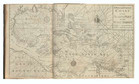
The English Pilot. The Fourth Book describing the West-India Navigation, from Hudson's Bay to the River Amazones. London: Mount and Page, 1784.
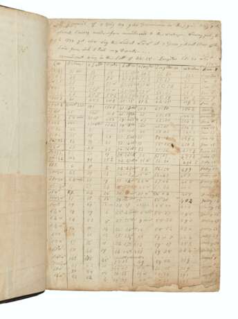
Extremely important atlas of sea-charts of the whole of the North American eastern seaboard, used by at least two different contemporary colonial sailors to navigate the seas between Maine, Boston and the West Indies. 'The first significant collection of charts exclusively of the American coasts to be published in England' (Cumming, p.9). The series of English Pilot books was started in 1671 by John Seller, whose charts derived from the Dutch pilot books of Pieter Goos. 'Seller's English Pilot initiated the independent production of pilot books in England which ultimately overcame Dutch predominance' (Koeman, IV, p. xiii). 'For British trading in North America and for the colonists there, the publication of The English Pilot: The Fourth Book must have been a godsend. For the first time an English sea atlas presented charts of the whole eastern seacoast of North America. To modern eyes the charts are crude and sparse of detail; but to the navigator of American waters in that period, it was his Bible. Whatever its shortcomings, there was really no substitute, no real competitor, for over sixty years' (William P. Cumming, British Maps of Colonial America, Chicago & London 1974, p.39). This work was in such high demand that 37 editions were published from 1689 to 1794, as were three pirated editions. During the history of publication, the charts went through numerous changes, starting with the addition to the 18 charts in the first edition to an eventual 26 in the final (this edition has 22). Nearly every chart in the Fourth Book was reworked and charts were added and replaced by more accurate charts with subsequent editions. Verner notes that 64 different chart titles have been recorded from the editions he examined. Due to its practical nature and use, copies of all editions are quite rare. Phillips Atlases 1171; Verner Bibliography of the Fourth Book of the English Pilot.
Folio (470 x 300mm). 22 engraved charts, all but one double-page, of which 13 folding, 4 engraved maps in the text, numerous woodcut coastal profiles throughout (variable spotting and soiling to charts, 3 folding charts with tiny holes at creasefold joins but without loss, title with fore-edge margin repaired and a number of other text leaves with margins strengthened, corner of pp.55-56 chipped and repaired with some associated tears running into text affecting a few letters). Contemporary calf (rebacked and recornered, extremities lightly rubbed, ring mark and light scoring to upper cover).
| Adresse de l'enchère |
CHRISTIE'S 8 King Street, St. James's SW1Y 6QT London Royaume-Uni | |
|---|---|---|
| Aperçu |
| |
| Téléphone | +44 (0)20 7839 9060 | |
| Commission | see on Website | |
| Conditions d'utilisation | Conditions d'utilisation |


