ID 1073323
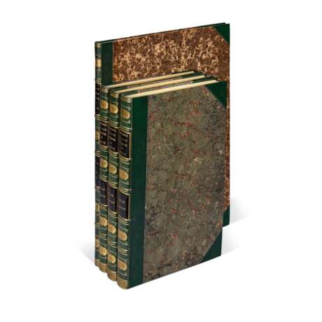
Lot 34 | Louis-Claude de Saulces de Freycinet | Voyage autour du monde. Paris, 1824-1826, 4 atlas volumes
Valeur estimée
£ 30 000 – 50 000
Voyage autour du monde: atlas historique, zoologie, botanique, [and] Navigation et hydrographie. Paris: chez Pillet l’ainé, 1824-1826
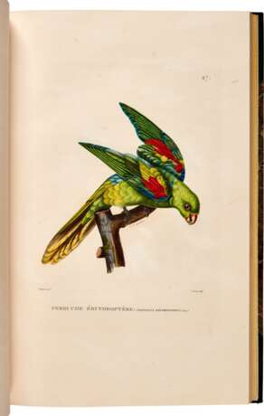
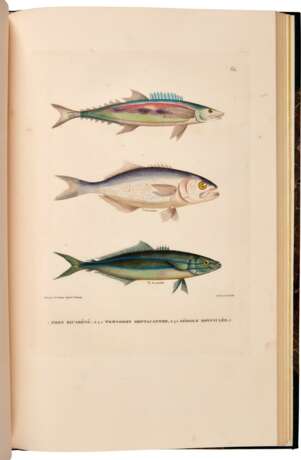
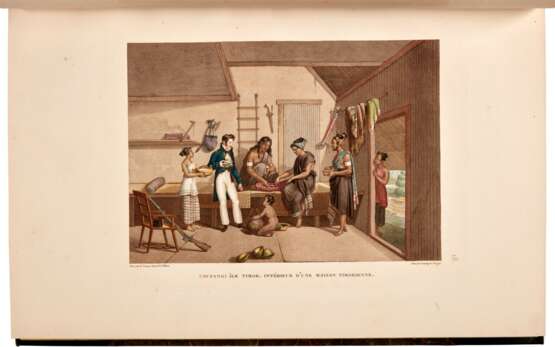
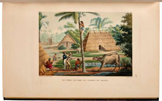
FIRST EDITION, 4 atlas volumes (without the 12 text volumes), folio (472 x 300mm.; “Navigation et Hydrographie” 582 x 428mm.), 350 engraved plates and maps, 119 in colour, distributed as follows: “Atlas Historique” with engraved title page with vignette, 112 engraved maps, plans, views/scenes, and portraits, 42 of the scenes and portraits HAND COLOURED OR PRINTED IN COLOUR AND FINISHED BY A CONTEMPORARY HAND, two of the maps folding; “Atlas Zoologie” with engraved title, 96 engraved plates showing mammals, birds, sea creatures, shells, and insects, 77 of these hand-coloured or printed in colour and finished by hand; “Atlas Botanique” with engraved title, 120 engraved plates; “Atlas Navigation et Hydrographie” with l22 engraved maps and charts, 10 double-page, later green half morocco over marbled boards in period style, the “Navigation et Hydrographie” volume preserving original marbled boards with presentation lettering in gilt on front cover: “Offert à la Société Royale d’Edinburgh par le Dépôt Général de la Marine”, occasional foxing and browning
THE STREETER COPY, and an attractive set of the atlases that accompanied the official account of Freycinet’s voyage of scientific exploration, considered one of the most important nineteenth-century circumnavigations of the globe. Wantrup notes that “complete sets are of the greatest rarity”. The maps in the “Navigation” show the route of Freycinet’s voyage, the lands visited, and charts of the seas traversed.
On the ship “Uranie,” Freycinet (1779–1841) and his crew, including marine hydrologist Louis Isidore Duperrey, artist Jacques Arago, and junior draughtsman Adrien Taunay fils, sailed to the islands of the Western Pacific, including the Hawaiian (Sandwich) Islands, Guam, Tonga, and Mauritius, then on to Australia, New Zealand, and South America. The “Uranie” ran aground in the Falkland Islands, and Freycinet completed his voyage back to France on the “Physicienne,” which visited Rio de Janeiro on the way. An additional passenger on the voyage was Freycinet’s wife, Rose, who was smuggled on board before the ship left Le Havre and who stayed by her husband’s side through the whole journey. As women were considered by some superstitious seamen to be unlucky on ships, this caused some consternation among the crew. According to Hill, “Freycinet named an island he discovered after her—Rose Island among the Samoa Islands.” As the inscription on the front of “Navigation et Hydrographie” states, this set was presented to the Royal Society of Edinburgh by the Dépôt des cartes et plans de la Marine, the central charting institution of France.
This set was owned by Frank Sherman Streeter (1918-2006) was the son of Thomas Streeter, one of the greatest American collectors of the 20th century and the leading collector of Americana. A Navy veteran who served in the Pacific during World War II, Frank focused his own collection on travel and exploration, especially Pacific and Arctic voyages. His purchases at the auction of his father’s library formed the foundation of the collection he built over forty years.
| Catégorie maison de vente aux enchères: | Impressions, graphiques, livres |
|---|
| Catégorie maison de vente aux enchères: | Impressions, graphiques, livres |
|---|
| Adresse de l'enchère |
Sotheby´s 34-35 New Bond Street W1A 2AA London Royaume-Uni | |
|---|---|---|
| Aperçu |
| |
| Téléphone | +44 (0) 20 7293 5000 | |
| Téléphone | +1 212 606 7000 | |
| Conditions d'utilisation | Conditions d'utilisation |
