ID 794515
Lot 191 | DES BARRES, Joseph Frederick Wallet (1729-1824)
Valeur estimée
£ 300 000 – 500 000
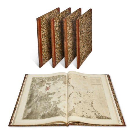
The Atlantic Neptune, published for the use of the Royal Navy of Great Britain ... under the Directions of the Right Honble. the Lords Commissioners of the Admiralty. London: 1776-1781].
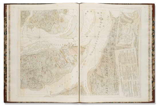
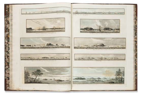
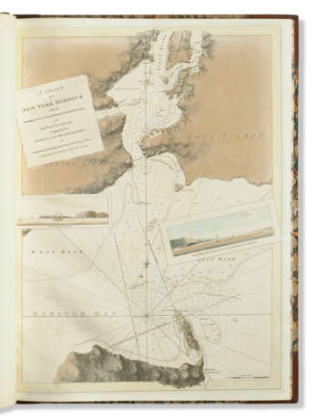
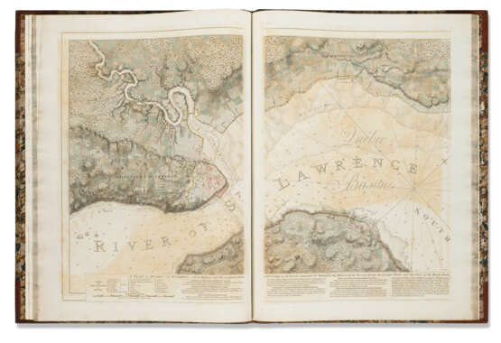
A fine set of Des Barres's Atlantic Neptune, 'one of the most remarkable products of human industry which has been given to the world through the arts of printing and engraving' (Stevens). This magnificent atlas covers the coasts of Nova Scotia (volumes 1 and 2), the coasts and harbours of the Gulf and River of Saint Lawrence (volume 3), the coast and harbours of the Atlantic coast of North America, from New York to the Gulf of Mexico (volume 4), and the coast and harbours of New England (volume 5). Des Barres, a British military engineer with extensive service in the New World, devoted sixteen years to his meticulous coastal survey of North America. The charts that comprise the resulting Atlantic Neptune are the foremost cartographical achievement of the American Revolution. They depict the banks, rocks, shoals, and soundings of the coastlines and provide comment and direction on navigation and pilotage. Copies of the Atlantic Neptune were compiled on a bespoke basis, principally for naval captains or merchant mariners; there is no standard collation, and no two recorded copies contain precisely the same charts. As early as 1832, Obadiah Rich recognized the Atlantic Neptune as the 'most splendid collection of charts, plans, and views ever published. It was executed at the expense of the British government for the use of the British navy, and no expence seems to have been spared in the execution to render it an monument worthy of the nation' (Bibliotheca Americana Nova 1:249). NMM III, 380; Phillips, Atlases 1198-1205; Streeter sale Christie's New York 16 April 2007, lot 148; Howes D271.
5 volumes, broadsheets (838 x 610 mm; watermarked JBATES). 3 engraved general titles with volume numbers, 3 engraved title-pages, 1 engraved section title; 102 engraved charts after surveys by Des Barres on 205 sheets, the principal features tinted or coloured by hand, including inset plans, maps, and vignette views; 31 sheets of engraved views and elevations (many with multiple images), mostly tinted or coloured by hand; double-sheet engraved map of Pennsylvania; engraved key to references leaf in volumes 1, 3, 4, and 5 (as called for); engraved contents leaf in volumes 1, 2, 4, and 5 (evidently lacking from volume 3), those in the final two volumes with extensive contemporary manuscript additions; letterpress broadside describing 'A Chart of the Harbour of Boston' in final volume (scattered offsetting and spotting, some show-through of sepia wash, a very few sheets with short marginal tears or repairs, but overall a fine copy). 19th-century half russia, smooth spines gilt and blind-rolled, covers, endpapers, and edges marbled en suite (extremities rubbed, a few joints just cracked at head or foot). Provenance: The Duke of Northumberland (Percy bookplate, dated 1867; Sotheby's London, 27 November 1978, lot 44).
Special notice
No VAT on hammer price or buyer's premium.
| Lieu d'origine: | Europe du Nord, Europe, Royaume-Uni |
|---|---|
| Catégorie maison de vente aux enchères: | Cartes et Atlas |
| Lieu d'origine: | Europe du Nord, Europe, Royaume-Uni |
|---|---|
| Catégorie maison de vente aux enchères: | Cartes et Atlas |
| Adresse de l'enchère |
CHRISTIE'S 8 King Street, St. James's SW1Y 6QT London Royaume-Uni | |
|---|---|---|
| Aperçu |
| |
| Téléphone | +44 (0)20 7839 9060 | |
| Commission | see on Website | |
| Conditions d'utilisation | Conditions d'utilisation |
