ID 1105727
Лот 91 | JAILLOT, Alexis Hubert (c.1632-1712)
Оценочная стоимость
£ 15 000 – 25 000
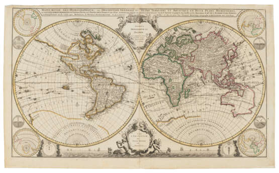
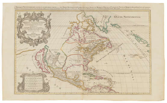
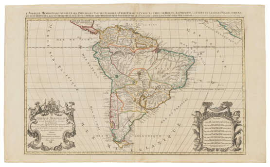
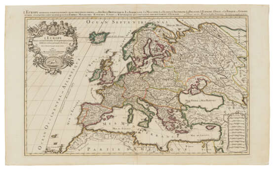
Mappe-Monde Geo-Hydrographique [With:] – Europe [With:] – Asie [With:] – Afrique [With:] Amérique Septentrionale [And:] – Amérique Meridionale. A collection of 6 maps from Atlas Nouveau. Amsterdam: Pierre Mortier, [c.1696-1708].
Fine, impressive world and continental maps from the Mortier edition of Jaillot’s Atlas Nouveau. In 1664, Jaillot married into the map-making family of Nicolas Berey, and in 1668 Jaillot took over his father-in-law’s shop and stock. He based his success on the re-engraving and publishing of Sanson's maps and atlases. 'By 1681 Jaillot had enough material to publish L'Atlas Nouveau. With the destruction of the Blaeu family business by fire in 1672, and the general lack of other competition, a ready market for a quality atlas had grown' (Burden). 'Jaillot's maps are in large and handsome format … the titles and scales of miles within elaborate and large cartouches’ (Tooley, p. 41). Later, Pierre Mortier would pirate Jaillot’s work by adding his own imprint, and the maps in the present lot most probably come from one of the Mortier atlases published between 1698-1708.
The lot includes a double-hemisphere world map, showing California as an island, and parts of New Zealand and Australia. The cartography is partly derived from two maps both published in 1700, Delisle’s world map and Nolin’s wall map, as it shows the large Mer D’Ouest extending into the centre of North America, and a northern channel connecting this with Hudson’s Bay. Australia’s eastern coast is conjectured to join New Guinea and Tasmania. While Europe, Asia and Africa appear each appear on single maps, the Americas are split onto two, L'Amerique Septentrionale and L’Amerique meridionale, the former also showing California as an island. See Koeman III, Mor 1, nos. 2-7; Pastoureau Jaillot I F, nos. 1-6.
Comprising 6 double-page engraved maps hand-coloured in outline, all on two joined sheets (630 x 1030mm), thus:
1. Mappe-Monde Geo-Hydrographique, ou Description Generale du Globe Terrestre et Aquatique en Deux Plans Hemispheres. Double-hemisphere world map after Delisle and Nolin, elaborate title and imprint cartouches, the latter at bottom supported by mermaids and dolphins within a seascape with vessels, four circular projections of high latitudes at corners, together with 6 smaller circular astronomical and mathematical diagrams.
2. L'Europe distinguée suivant le stendue de ses principales parties. Large title cartouche within elaborate frame to upper left, scale cartouche to lower right, prime meridian running through Iceland and the Canary Islands, portion of the coastline of Nova Zembla depicted.
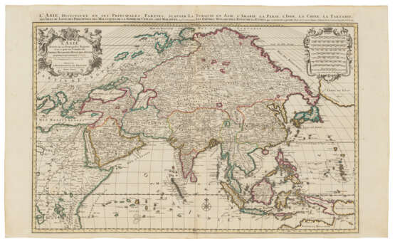
3. L'Asie distinguée en ses principales parties. Large title and scale cartouches within elaborate frames to top corners, northern coastline of Australia open at Carpentaria, ‘Terre de Papous’ and ‘Nouvelle Guinea’ shown as two islands, the former without eastern coastline, large landmass in the northern Pacific Ocean almost touching Asia entitled ‘Terre de Iesso’
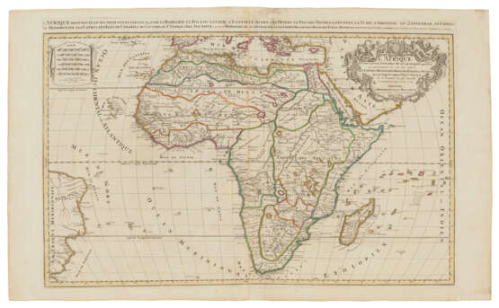
4. L'Afrique distinguée en ses principales parties. Title cartouche to upper right over most of Arabia within elaborate frame, scale cartouche to upper left, eastern coast of South America shown at western edge, fictious island S. Helena Nova shown in South Atlantic. This is probably the 4th Mortier edition of Jaillot’s map of Africa. Betz 118; Norwich (1997) 46.
5. L'Amerique Septentrionale Divisée en ses Principales Parties. Very large title and scale cartouches to left-hand corners within elaborate frames, California depicted as an island, with outline of the coast of ‘Terre de Iesso’ to California’s west, Montreal omitted but with French missions shown around the Great Lakes, two of which are left open at their western ends. Burden II, 438 (this undated state not described); Tooley California 37 (pl. 44);
6. L'Amerique Meridionale Divisée en ses Principales Parties. Very large title and scale cartouches to lower corners within elaborate frames, very small portion of western coast of Africa shown at eastern edge, this map still retaining Paris imprint of Jaillot in scale cartouche.
Provenance: occasional early neat ink annotations to maps, sometimes indicating territories, e.g. 'Fr' for French, or stating the areas in which some animals are found.
| Адрес торгов |
CHRISTIE'S 8 King Street, St. James's SW1Y 6QT London Великобритания | ||||
|---|---|---|---|---|---|
| Предосмотр |
| ||||
| Телефон | +44 (0)20 7839 9060 | ||||
| Комиссия | see on Website | ||||
| Условия использования | Условия использования |
