ID 1360773
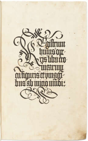
Лот 57 | Nuremberg Chronicle
Оценочная стоимость
$ 25 000 – 35 000
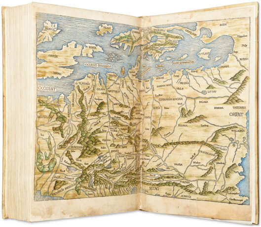
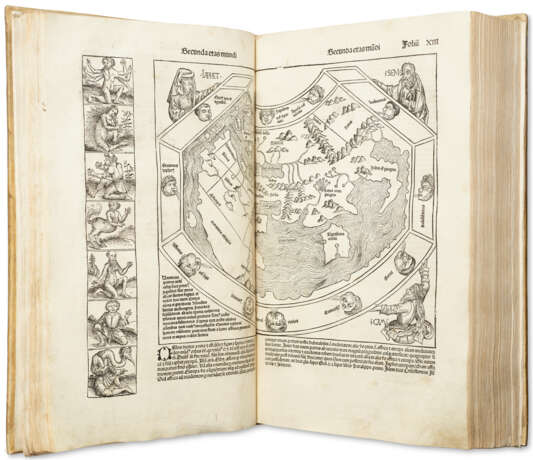
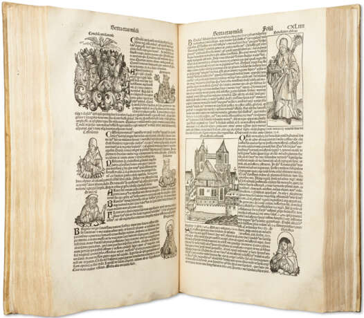
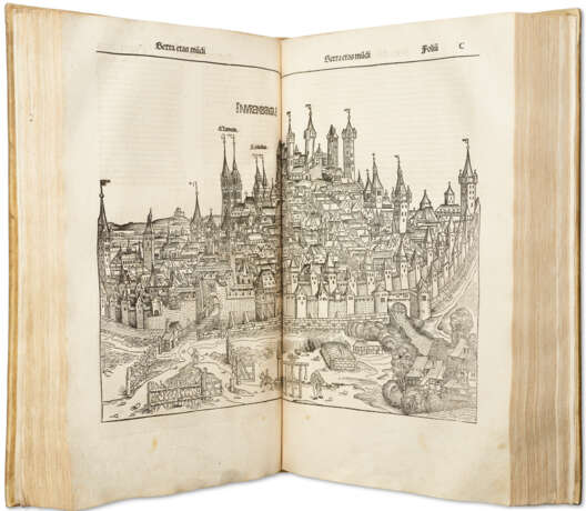
First edition of the most extensively illustrated book of the 15th century, a tall copy with contemporary hand-colored map of Europe. The Nuremberg Chronicle is celebrated for its fine and numerous woodcut illustrations, to which Albrecht Dürer is believed to have contributed (see The Making of the Nuremberg Chronicle). It also includes two important double-page maps: a fine world map based on Mela’s Cosmographia of 1482 (see Shirley 19), and a map of northern and central Europe by Hieronymus Münzer (1437–1508) after Nicolas Khyrpffs. The mappa mundi is one of only three 15th-century maps conveying Portuguese knowledge of the Gulf of Guinea from about 1470. The map of Europe is closely associated with Nicolas of Cusa’s Eichstätt map, with which it is thought to share a common manuscript source of c.1439–54. It is therefore claimed to be the first modern map of this region to appear in print. Although published later than the map of Germany in the 1482 Ulm Ptolemy, it was constructed earlier (Campbell). The publication history of the Nuremberg Chronicle is perhaps the best documented of any book printed in this period: the contracts between Schedel and his partners Schreyer and Kammermaister, and between Schedel and the artists, all survive in the Stadtsbibliothek Nuremberg, as do detailed manuscript exemplars of both the Latin and the German editions. The two editions were planned simultaneously, but the German was published five months after the present Latin edition. A. Wilson, The Making of the Nuremberg Chronicle (Amsterdam, 1976). T. Campbell, The Earliest Printed Maps, 1472–1500 (British Library, 1987). HC *14508; BMC II 437; BSB-Ink S-195; Bod-inc S-108; CIBN S-161; GW M40784; Goff S-307; Schramm XVII p. 9; Klebs 889.1; ISTC is00307000.
Imperial folio (457 × 285mm). 325 leaves (of 326, without last blank). 2 double-page maps, the map of Europe with contemporary color (Europe map margins repaired, paper strengthened, stains to verso). Calligraphic woodcut title, 1,809 woodcut illustrations printed from 645 blocks (S.C. Cockerell’s count, Some German Woodcuts of the Fifteenth Century (Kelscott Press, 1897), pp. 35–36) by Michael Wolgemut, Wilhelm Pleydenwurff and their workshop including Albrecht Dürer (light stains and creasing, numerous leaves with repaired tears mostly marginal but extending through image or text in half a dozen places, first and last quires strengthened at gutter; CCLVIII and CCLX with margins extended). Old vellum (rebacked, two small portions of original spine laid down, extremities of boards and endpapers renewed). Provenance: early marginalia – Count Francis [?], a priest at Reggio (early inscription preserved on endpaper).
| Место происхождения: | Германия |
|---|---|
| Категория аукционного дома: | Антикварные книги, Медицина и наука, Печатные книги |
| Место происхождения: | Германия |
|---|---|
| Категория аукционного дома: | Антикварные книги, Медицина и наука, Печатные книги |
| Адрес торгов |
CHRISTIE'S 20 Rockefeller Plaza 10020 New York США | ||||||||||||||
|---|---|---|---|---|---|---|---|---|---|---|---|---|---|---|---|
| Предосмотр |
| ||||||||||||||
| Телефон | +1 212 636 2000 | ||||||||||||||
| Факс | +1 212 636 4930 | ||||||||||||||
| Условия использования | Условия использования | ||||||||||||||
| Транспортировка |
Почтовая служба Курьерская служба Самовывоз | ||||||||||||||
| Способы оплаты |
Банковский перевод | ||||||||||||||
| Часы работы | Часы работы
|
