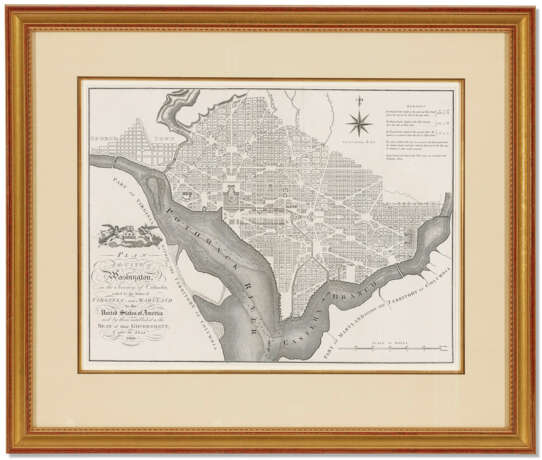
Plan of the City of Washington

Лот 140
25.04.2022 10:00UTC -05:00
Classic
Продан
$ 2 142
AuctioneerCHRISTIE'S
Место проведенияСША, New York
Архив
Аукцион завершен. Ставки на лот больше не принимаются.
Archive
ID 743800
Лот 140 | Plan of the City of Washington
Оценочная стоимость
$ 1 000 – 1 500
[ELLICOTT, Andrew (1754-1820), after, and RUSSELL, John C., engraver.] Plan of the City of Washington, in the Territory of Columbia, ceded by the States of Virginia and Maryland to the United States of America, and by them Established as the Seat of their Government after the year 1800. [London: John Reid, 1795.]London printing of the plan of the newly-designed Federal capital. It is practically identical to the first edition, published in Philadelphia in 1792. "No more attractive example of urban cartography can be found" (Reps). Although it was preceded by the maps of Samuel Hill and the smaller near-plagiarism by Thackara and Vallance themselves, this map of the District was the first one used by the Commissioners, and the one intended by Ellicott as the city's first plan. Furthermore, this mapping includes soundings, canals, and other important details that are not to be found in its usurpers. Reps, Washington on View, p. 38. See American Cities, pp. 61ff. Engraved map, 400 x 535mm sight size. (A little very mild creasing visible in upper right corner.) Archivally matted, framed and glazed to 25½ x 30 inches. [With]: a copy of American Cities: Historic Maps and Views. Assouline, 2005. Folio.
Адрес торгов CHRISTIE'S
20 Rockefeller Plaza
10020 New York
США
Предосмотр
11.04.2022 – 25.04.2022
Телефон +1 212 636 2000
Факс +1 212 636 4930
E-mail
Условия использованияУсловия использования
Транспортировка Почтовая служба
Курьерская служба
Самовывоз
Способы оплаты Банковский перевод
Часы работыЧасы работы
Пн 09:30 – 17:00   
Вт 09:30 – 17:00   
Ср 09:30 – 17:00   
Чт 09:30 – 17:00   
Пт 09:30 – 17:00   
Сб закрыто
Вс закрыто

Связанные термины

?>