ID 1119163
Лот 67 | "Holster Atlas" of the Revolution
Оценочная стоимость
$ 5 000 – 8 000
Sayer & Bennett, 1776
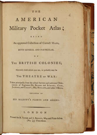
AMERICAN REVOLUTION – The American Military Pocket Atlas. London: R. Sayer and J. Bennet, [1776].
First edition of the so-called Holster Atlas, designed “to suit the pockets of officers of all ranks” for use in the field during the American Revolution. The maps are those “that the British high command regarded as providing essential topographical information in the most convenient form” (Schwartz & Ehrenberg). To quote the advertisement on p.vii of this work, “Surveys and Topographical Charts being fit only for a Library, such Maps as an Officer may take with him into the Field have been much wanted. The following Collection forms a Portable Atlas of North America, calculated in its Bulk and Price to suit the pockets of officers of all ranks.” Howes A-208; Nebenzahl, Atlas of the American Revolution pp. 11-15 & 61-63; Sabin 1147; Schwartz & Ehrenberg, p 190; Streeter sale 73.
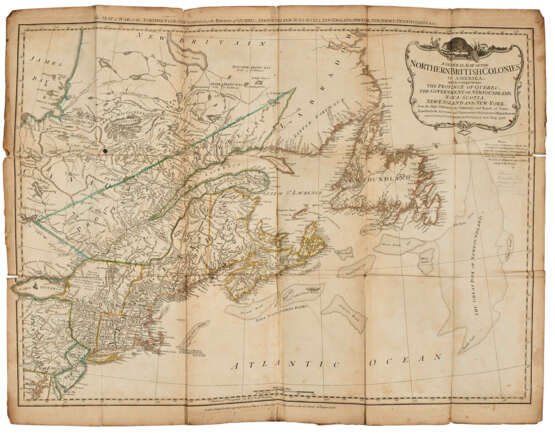
Octavo (225 x 148mm). Printed on thick paper. Including six folding engraved maps, hand-colored in outline, comprising: 1. DUNN, Samuel. North America as Divided amongst the European Powers. 1774. 2. DUNN. A Compleat Map of the West Indies. 1774. 3. A General Map of the Northern British Colonies in America. Which comprehends the Province of Quebec, The Government of Newfoundland, Nova-Scotia, New-England and New-York. 1776. 4. A General Map of the Middle British Colonies, in America. Containing Virginia, Maryland, the Delaware Counties, Pennsylvania and New Jersey. 1776. 5. ROMANS, Bernard. A General Map of the Southern British Colonies, in America. Comprehending North and South Carolina, Georgia, East and West Florida. 1776. 6. BRASSIER, William. A Survey of Lake Champlain, including Lake George, Crown Point and St. John. 1776. Second issue as usual, updated to include information on the October Battle of Valcour Island. (A little dirty, some spotting, scattered small old repairs at fold intersection versos, scattered small splits at folds, chiefly at edges and intersections; map 6 detached and laid in.) Later half calf over marbled boards (scuffed, r.f.e. creased, springing, some pencil scrawls including over manuscript on f.f.e.). Provenance: contemporary or early manuscript on front free endpaper, being a list of sailing terms and their French translations – Ernest E. Keet (bookplate).
| Место происхождения: | Англия, Северная Европа, Европа, Великобритания |
|---|---|
| Категория аукционного дома: | Карты и атласы |
| Место происхождения: | Англия, Северная Европа, Европа, Великобритания |
|---|---|
| Категория аукционного дома: | Карты и атласы |
| Адрес торгов |
CHRISTIE'S 20 Rockefeller Plaza 10020 New York США | ||||||||||||||
|---|---|---|---|---|---|---|---|---|---|---|---|---|---|---|---|
| Предосмотр |
| ||||||||||||||
| Телефон | +1 212 636 2000 | ||||||||||||||
| Факс | +1 212 636 4930 | ||||||||||||||
| Условия использования | Условия использования | ||||||||||||||
| Транспортировка |
Почтовая служба Курьерская служба Самовывоз | ||||||||||||||
| Способы оплаты |
Банковский перевод | ||||||||||||||
| Часы работы | Часы работы
|


