ID 1028576
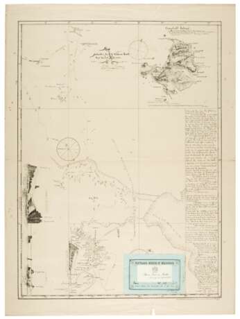
Лот 263 | Map of Antarctic's track to Victoria Land, 1894-95
Оценочная стоимость
£ 1 000 – 1 500
682 x 508mm., map by Captain L. Kristensen of the Antarctic, with the assistance of Sir James Ross's observations. Meteorological observations taken on board the Antarctic during the months December 1894 and January 1895, previously folded, light spotting, some creases and closed tears at margin
The map shows icebergs, the border of the pack ice and the date at which each point on the route was reached by the ship Antarctic. It also includes explorer's notes on Campbell Island and Victoria Land. Insets: Campbell Island, Scale ca. 1:120000; Sketches of Cape Adare, Sven Foyn Island and Ross Island.
| Адрес торгов |
Sotheby´s 34-35 New Bond Street W1A 2AA London Великобритания | ||||||
|---|---|---|---|---|---|---|---|
| Предосмотр |
| ||||||
| Телефон | +44 (0) 20 7293 5000 | ||||||
| Телефон | +1 212 606 7000 | ||||||
| Условия использования | Условия использования |


